Area Overview for WF17 8FG
Photos of WF17 8FG
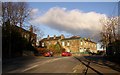
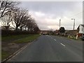
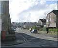
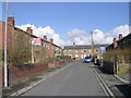
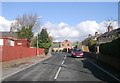
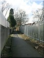
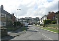
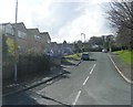
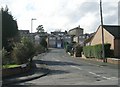
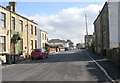
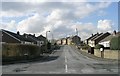
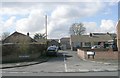
100 photos from this area
Area Information
Key information about the WF17 8FG including its size, population, and administrative classification.
- Area Type
- Postcode
- Area Size
- 8121 m²
- Population
- 2018
- Population Density
- 3872 people/km²
House Prices in WF17 8FG
22
Properties
£146,792
Average Sold Price
£98,000
Lowest Price
£191,000
Highest Price
Showing 22 properties
| Address | Type | Beds | Baths | Last Sale Price | Last Sale Date | |
|---|---|---|---|---|---|---|
| 11 Greenfield View, Carlinghow, Batley, WF17 8FG | Terraced | 3 | 1 | £191,000 | Jan 2024 | |
| 33 Greenfield View, Carlinghow, Batley, WF17 8FG | Semi-detached | 3 | 1 | £180,000 | Sep 2023 | |
| 5 Greenfield View, Carlinghow, Batley, WF17 8FG | Terraced | 3 | 1 | £169,950 | Aug 2023 | |
| 23 Greenfield View, Carlinghow, Batley, WF17 8FG | Terraced | 3 | 1 | £144,000 | Mar 2023 | |
| 41 Greenfield View, Carlinghow, Batley, WF17 8FG | Semi-detached | 3 | 1 | £135,000 | Jan 2023 | |
| 35 Greenfield View, Carlinghow, Batley, WF17 8FG | Terraced | 3 | 1 | £181,500 | Oct 2022 | |
| 1 Greenfield View, Carlinghow, Batley, WF17 8FG | Semi-detached | 3 | 2 | £142,500 | May 2021 | |
| 45 Greenfield View, Carlinghow, Batley, WF17 8FG | Terraced | 3 | 1 | £130,000 | Aug 2020 | |
| 29 Greenfield View, Carlinghow, Batley, WF17 8FG | Terraced | 3 | 1 | £135,000 | Jun 2019 | |
| 19 Greenfield View, Carlinghow, Batley, WF17 8FG | Terraced | 3 | 1 | £144,000 | Jun 2019 |
Page 1 of 3
Energy Efficiency in WF17 8FG
Amenities
Schools
| Rank | School | Type | Entry gender | Ages |
|---|
Explore more schools in this area
Go to Schools tabDemographics
Household Size
Family (3-5 people)
most common
Accommodation Type
Houses
most common
Tenure
80
majority
Ethnic Group
White
most common
Religion
N/A
most common
Household Composition
N/A
most common
Age
47
median
Adults (30-64 years)
most common
Household Deprivation
N/A
with no deprivation
NS-SEC
31
in Lower managerial occupations
Explore more demographic insights in this area
Go to Demographics tabPlanning
Planning Constraints
- Flood RiskPremium
- Ramsar Wetland SitesPremium
- Area of Outstanding Natural BeautyPremium
- Protected Nature ReservePremium
- Protected WoodlandPremium