Area Overview for WF17 0HE
Photos of WF17 0HE
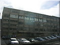


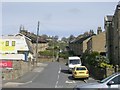
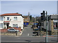
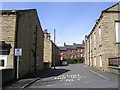

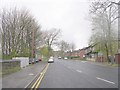

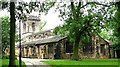
100 photos from this area
Area Information
Key information about the WF17 0HE including its size, population, and administrative classification.
- Area Type
- Postcode
- Area Size
- 8024 m²
- Population
- 1567
- Population Density
- 195283 people/km²
House Prices in WF17 0HE
9
Properties
£159,421
Average Sold Price
£85,000
Lowest Price
£285,000
Highest Price
Showing 9 properties
| Address | Type | Beds | Baths | Last Sale Price | Last Sale Date | |
|---|---|---|---|---|---|---|
| 11 County Close, Batley, WF17 0HE | Semi-detached | 3 | 1 | £165,000 | Nov 2021 | |
| 9 County Close, Batley, WF17 0HE | house | - | - | £175,000 | Jun 2019 | |
| County View, 1A County Close, Batley, WF17 0HE | Detached | 5 | 3 | £285,000 | Jan 2019 | |
| 13 County Close, Batley, WF17 0HE | Semi-detached | 3 | 1 | £137,000 | Aug 2014 | |
| 7 County Close, Batley, WF17 0HE | Semi-detached | 3 | - | £124,950 | Dec 2013 | |
| 1 County Close, Batley, WF17 0HE | Detached | 5 | 3 | £85,000 | Jun 2010 | |
| 3 County Close, Batley, WF17 0HE | house | - | - | £144,000 | Feb 2007 | |
| 5 County Close, Batley, WF17 0HE | Semi-detached | - | - | - | - | |
| 15 County Close, Batley, WF17 0HE | house | - | - | - | - |
Energy Efficiency in WF17 0HE
Amenities
Schools
| Rank | School | Type | Entry gender | Ages |
|---|
Explore more schools in this area
Go to Schools tabDemographics
Household Size
One person
most common
Accommodation Type
Flats
most common
Tenure
29
majority
Ethnic Group
White
most common
Religion
N/A
most common
Household Composition
N/A
most common
Age
47
median
Adults (30-64 years)
most common
Household Deprivation
N/A
with no deprivation
NS-SEC
16
in Lower managerial occupations
Explore more demographic insights in this area
Go to Demographics tabPlanning
Planning Constraints
- Flood RiskPremium
- Ramsar Wetland SitesPremium
- Area of Outstanding Natural BeautyPremium
- Protected Nature ReservePremium
- Protected WoodlandPremium