Area Overview for WF15 6EP
Photos of WF15 6EP
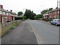
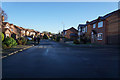
100 photos from this area
Area Information
Key information about the WF15 6EP including its size, population, and administrative classification.
- Area Type
- Postcode
- Area Size
- 6647 m²
- Population
- 1544
- Population Density
- 900 people/km²
House Prices in WF15 6EP
17
Properties
£84,071
Average Sold Price
£28,500
Lowest Price
£142,500
Highest Price
Showing 17 properties
| Address | Type | Beds | Baths | Last Sale Price | Last Sale Date | |
|---|---|---|---|---|---|---|
| 7 Listing Lane, Littletown, Liversedge, WF15 6EP | Bungalow | 2 | 1 | £137,000 | May 2021 | |
| 15 Listing Lane, Littletown, Liversedge, WF15 6EP | house | - | - | £142,500 | Aug 2020 | |
| 3 Listing Lane, Littletown, Liversedge, WF15 6EP | house | - | - | £95,500 | Feb 2019 | |
| 23A Listing Lane, Littletown, Liversedge, WF15 6EP | Flat | - | - | £70,000 | May 2018 | |
| 34 Listing Lane, Littletown, Liversedge, WF15 6EP | Terraced | - | - | £70,000 | Jun 2012 | |
| 9 Listing Lane, Littletown, Liversedge, WF15 6EP | Semi-detached | - | - | £45,000 | May 2002 | |
| 32 Listing Lane, Littletown, Liversedge, WF15 6EP | Terraced | - | - | £28,500 | Jun 1995 | |
| 46 Listing Lane, Littletown, Liversedge, WF15 6EP | undefined | - | - | - | - | |
| 17A Listing Lane, Littletown, Liversedge, WF15 6EP | Flat | - | - | - | - | |
| 11 Listing Lane, Littletown, Liversedge, WF15 6EP | Semi-detached | - | - | - | - |
Page 1 of 2
Energy Efficiency in WF15 6EP
Amenities
Schools
| Rank | School | Type | Entry gender | Ages |
|---|
Explore more schools in this area
Go to Schools tabDemographics
Household Size
Family (3-5 people)
most common
Accommodation Type
Houses
most common
Tenure
69
majority
Ethnic Group
White
most common
Religion
N/A
most common
Household Composition
N/A
most common
Age
47
median
Adults (30-64 years)
most common
Household Deprivation
N/A
with no deprivation
NS-SEC
29
in Lower managerial occupations
Explore more demographic insights in this area
Go to Demographics tabPlanning
Planning Constraints
- Flood RiskPremium
- Ramsar Wetland SitesPremium
- Area of Outstanding Natural BeautyPremium
- Protected Nature ReservePremium
- Protected WoodlandPremium