Area Overview for WF13 2LB
Photos of WF13 2LB


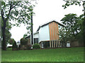
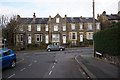
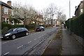

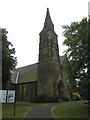
100 photos from this area
Area Information
Key information about the WF13 2LB including its size, population, and administrative classification.
- Area Type
- Postcode
- Area Size
- 8821 m²
- Population
- 1373
- Population Density
- 3336 people/km²
House Prices in WF13 2LB
20
Properties
£131,244
Average Sold Price
£60,000
Lowest Price
£282,500
Highest Price
Showing 20 properties
| Address | Type | Beds | Baths | Last Sale Price | Last Sale Date | |
|---|---|---|---|---|---|---|
| Elmcroft, 18 Moorlands Avenue West, Dewsbury, WF13 2LB | Terraced | 5 | 1 | £282,500 | Feb 2022 | |
| 48, Moorlands Court, Moorlands Avenue West, Dewsbury, WF13 2LB | Flat | - | - | £78,000 | Apr 2015 | |
| 42, Moorlands Court, Moorlands Avenue West, Dewsbury, WF13 2LB | Flat | - | - | £60,000 | May 2014 | |
| 30, Moorlands Court, Moorlands Avenue West, Dewsbury, WF13 2LB | Flat | 2 | 1 | £124,950 | Sep 2008 | |
| 40, Moorlands Court, Moorlands Avenue West, Dewsbury, WF13 2LB | Flat | 2 | 1 | £124,950 | Sep 2008 | |
| 46, Moorlands Court, Moorlands Avenue West, Dewsbury, WF13 2LB | Flat | 2 | 2 | £124,950 | Sep 2008 | |
| 50, Moorlands Court, Moorlands Avenue West, Dewsbury, WF13 2LB | Flat | - | - | £124,950 | Sep 2008 | |
| 32, Moorlands Court, Moorlands Avenue West, Dewsbury, WF13 2LB | Flat | - | - | £124,950 | Sep 2008 | |
| 44, Moorlands Court, Moorlands Avenue West, Dewsbury, WF13 2LB | Flat | - | - | £124,950 | Jul 2008 | |
| 38, Moorlands Court, Moorlands Avenue West, Dewsbury, WF13 2LB | Flat | - | - | £124,950 | Jun 2008 |
Page 1 of 2
Energy Efficiency in WF13 2LB
Amenities
Schools
| Rank | School | Type | Entry gender | Ages |
|---|
Explore more schools in this area
Go to Schools tabDemographics
Household Size
Family (3-5 people)
most common
Accommodation Type
Houses
most common
Tenure
73
majority
Ethnic Group
asian_total
most common
Religion
N/A
most common
Household Composition
N/A
most common
Age
47
median
Adults (30-64 years)
most common
Household Deprivation
N/A
with no deprivation
NS-SEC
29
in Lower managerial occupations
Explore more demographic insights in this area
Go to Demographics tabPlanning
Planning Constraints
- Flood RiskPremium
- Ramsar Wetland SitesPremium
- Area of Outstanding Natural BeautyPremium
- Protected Nature ReservePremium
- Protected WoodlandPremium