Area Overview for WF12 8LY
Photos of WF12 8LY
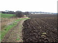
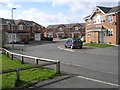
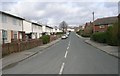
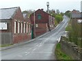
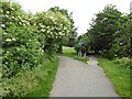
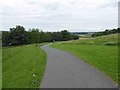
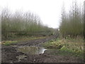
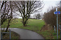
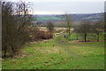
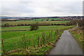
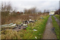
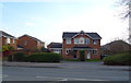
49 photos from this area
Area Information
Key information about the WF12 8LY including its size, population, and administrative classification.
- Area Type
- Postcode
- Area Size
- 1.1 hectares
- Population
- 1949
- Population Density
- 1932 people/km²
House Prices in WF12 8LY
24
Properties
£90,222
Average Sold Price
£35,500
Lowest Price
£155,000
Highest Price
Showing 24 properties
| Address | Type | Beds | Baths | Last Sale Price | Last Sale Date | |
|---|---|---|---|---|---|---|
| 2 Ossett Lane, Chickenley, Dewsbury, WF12 8LY | Terraced | 3 | 1 | £155,000 | Aug 2025 | |
| 16A Ossett Lane, Chickenley, Dewsbury, WF12 8LY | Terraced | 2 | 1 | £81,000 | Jul 2023 | |
| 79 Ossett Lane, Chickenley, Dewsbury, WF12 8LY | house | 2 | 1 | £105,000 | Dec 2022 | |
| 81 Ossett Lane, Chickenley, Dewsbury, WF12 8LY | Terraced | 2 | 1 | £117,500 | Aug 2021 | |
| 85 Ossett Lane, Chickenley, Dewsbury, WF12 8LY | Semi-detached | 2 | 1 | £100,000 | Dec 2017 | |
| Lyndene, 77 Ossett Lane, Chickenley, Dewsbury, WF12 8LY | Terraced | 2 | - | £77,500 | Jun 2015 | |
| 16 Ossett Lane, Chickenley, Dewsbury, WF12 8LY | house | 3 | 2 | £126,000 | Apr 2007 | |
| 24 Ossett Lane, Chickenley, Dewsbury, WF12 8LY | Semi-detached | - | - | £95,000 | Nov 2005 | |
| 22 Ossett Lane, Chickenley, Dewsbury, WF12 8LY | Semi-detached | - | - | £54,995 | Mar 2001 | |
| 10 Ossett Lane, Chickenley, Dewsbury, WF12 8LY | Terraced | - | - | £44,950 | Jul 2000 |
Page 1 of 3
Energy Efficiency in WF12 8LY
Amenities
Schools
| Rank | School | Type | Entry gender | Ages |
|---|
Explore more schools in this area
Go to Schools tabDemographics
Household Size
Two person
most common
Accommodation Type
Houses
most common
Tenure
68
majority
Ethnic Group
White
most common
Religion
N/A
most common
Household Composition
N/A
most common
Age
47
median
Adults (30-64 years)
most common
Household Deprivation
N/A
with no deprivation
NS-SEC
25
in Lower managerial occupations
Explore more demographic insights in this area
Go to Demographics tabPlanning
Planning Constraints
- Flood RiskPremium
- Ramsar Wetland SitesPremium
- Area of Outstanding Natural BeautyPremium
- Protected Nature ReservePremium
- Protected WoodlandPremium