Area Overview for WF12 7NA
Photos of WF12 7NA

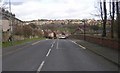
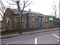
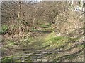
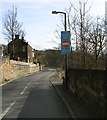
100 photos from this area
Area Information
Key information about the WF12 7NA including its size, population, and administrative classification.
- Area Type
- Postcode
- Area Size
- 9405 m²
- Population
- 2111
- Population Density
- 3251 people/km²
House Prices in WF12 7NA
19
Properties
£140,136
Average Sold Price
£57,000
Lowest Price
£240,000
Highest Price
Showing 19 properties
| Address | Type | Beds | Baths | Last Sale Price | Last Sale Date | |
|---|---|---|---|---|---|---|
| 18 Lichfield Road, Dewsbury, WF12 7NA | Detached | 3 | 1 | £237,500 | Jun 2025 | |
| 27 Lichfield Road, Dewsbury, WF12 7NA | Retail | 3 | 1 | £186,000 | Mar 2022 | |
| 31 Lichfield Road, Dewsbury, WF12 7NA | Detached | 4 | 1 | £240,000 | Dec 2018 | |
| 15 Lichfield Road, Dewsbury, WF12 7NA | Detached | 4 | - | £185,000 | Jul 2017 | |
| 24 Lichfield Road, Dewsbury, WF12 7NA | Semi-detached | 3 | 1 | £152,500 | Apr 2017 | |
| 29 Lichfield Road, Dewsbury, WF12 7NA | house | - | - | £125,000 | Nov 2011 | |
| 22 Lichfield Road, Dewsbury, WF12 7NA | Semi-detached | 3 | - | £110,000 | May 2010 | |
| 20 Lichfield Road, Dewsbury, WF12 7NA | house | - | - | £125,000 | Jan 2009 | |
| 25 Lichfield Road, Dewsbury, WF12 7NA | Semi-detached | - | - | £60,000 | Oct 2001 | |
| 16 Lichfield Road, Dewsbury, WF12 7NA | Detached | - | - | £63,500 | Aug 2000 |
Page 1 of 2
Energy Efficiency in WF12 7NA
Amenities
Schools
| Rank | School | Type | Entry gender | Ages |
|---|
Explore more schools in this area
Go to Schools tabDemographics
Household Size
Family (3-5 people)
most common
Accommodation Type
Houses
most common
Tenure
73
majority
Ethnic Group
White
most common
Religion
N/A
most common
Household Composition
N/A
most common
Age
47
median
Adults (30-64 years)
most common
Household Deprivation
N/A
with no deprivation
NS-SEC
27
in Lower managerial occupations
Explore more demographic insights in this area
Go to Demographics tabPlanning
Planning Constraints
- Flood RiskPremium
- Ramsar Wetland SitesPremium
- Area of Outstanding Natural BeautyPremium
- Protected Nature ReservePremium
- Protected WoodlandPremium