Area Overview for WF12 0LZ
Photos of WF12 0LZ
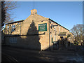
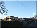
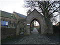
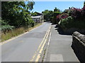
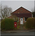
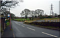
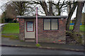
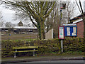
40 photos from this area
Area Information
Key information about the WF12 0LZ including its size, population, and administrative classification.
- Area Type
- Postcode
- Area Size
- 5.9 hectares
- Population
- 1137
- Population Density
- 177 people/km²
House Prices in WF12 0LZ
15
Properties
£292,886
Average Sold Price
£115,000
Lowest Price
£405,000
Highest Price
Showing 15 properties
| Address | Type | Beds | Baths | Last Sale Price | Last Sale Date | |
|---|---|---|---|---|---|---|
| Ash Lynn, Whitley Road, Whitley, Dewsbury, WF12 0LZ | house | - | - | £405,000 | Jun 2021 | |
| The Russets, 400 Whitley Road, Whitley, Dewsbury, WF12 0LZ | Semi-detached | - | - | £371,313 | Apr 2016 | |
| Well Garth House, Whitley Road, Whitley, Dewsbury, WF12 0LZ | Detached | 4 | 2 | £390,000 | May 2014 | |
| Aquaville, Whitley Road, Whitley, Dewsbury, WF12 0LZ | Detached | 4 | 2 | £236,000 | Feb 2014 | |
| Bagdale, Whitley Road, Whitley, Dewsbury, WF12 0LZ | Detached | 3 | 1 | £240,000 | Nov 2006 | |
| South View, Whitley Road, Whitley, Dewsbury, WF12 0LZ | Semi-detached | - | - | £115,000 | Jul 2003 | |
| Glenrose, Whitley Road, Whitley, Dewsbury, WF12 0LZ | house | 5 | - | - | - | |
| Living Accommodation, Woolpack Country Inn, Whitley Road, Whitley, Dewsbury, WF12 0LZ | Flat | - | - | - | - | |
| Rosegarth, Whitley Road, Whitley, Dewsbury, WF12 0LZ | Detached | - | - | - | - | |
| Shop, The Old Post Office, Whitley Road, Whitley, Dewsbury, WF12 0LZ | shop | - | - | - | - |
Page 1 of 2
Energy Efficiency in WF12 0LZ
Amenities
Schools
| Rank | School | Type | Entry gender | Ages |
|---|
Explore more schools in this area
Go to Schools tabDemographics
Household Size
Two person
most common
Accommodation Type
Houses
most common
Tenure
88
majority
Ethnic Group
White
most common
Religion
N/A
most common
Household Composition
N/A
most common
Age
47
median
Adults (30-64 years)
most common
Household Deprivation
N/A
with no deprivation
NS-SEC
44
in Lower managerial occupations
Explore more demographic insights in this area
Go to Demographics tabPlanning
Planning Constraints
- Flood RiskPremium
- Ramsar Wetland SitesPremium
- Area of Outstanding Natural BeautyPremium
- Protected Nature ReservePremium
- Protected WoodlandPremium