Area Overview for WF11 9NS
Photos of WF11 9NS
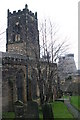


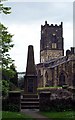
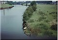

100 photos from this area
Area Information
Key information about the WF11 9NS including its size, population, and administrative classification.
- Area Type
- Postcode
- Area Size
- 1.4 hectares
- Population
- 1810
- Population Density
- 245 people/km²
House Prices in WF11 9NS
35
Properties
£120,440
Average Sold Price
£40,000
Lowest Price
£215,000
Highest Price
Showing 35 properties
| Address | Type | Beds | Baths | Last Sale Price | Last Sale Date | |
|---|---|---|---|---|---|---|
| 16 Sandringham Road, Byram, WF11 9NS | Bungalow | 2 | 1 | £185,000 | Mar 2025 | |
| 8 Sandringham Road, Byram, WF11 9NS | Bungalow | 3 | 1 | £200,000 | May 2024 | |
| 21 Sandringham Road, Byram, WF11 9NS | Bungalow | 2 | - | £215,000 | Aug 2022 | |
| 2 Sandringham Road, Byram, WF11 9NS | Bungalow | - | - | £178,000 | Jul 2021 | |
| 29 Sandringham Road, Byram, WF11 9NS | Bungalow | - | - | £155,000 | Dec 2020 | |
| 30 Sandringham Road, Byram, WF11 9NS | Bungalow | - | - | £143,500 | May 2020 | |
| 11 Sandringham Road, Byram, WF11 9NS | Bungalow | 2 | 1 | £115,000 | Dec 2018 | |
| 23 Sandringham Road, Byram, WF11 9NS | Bungalow | - | - | £150,000 | Nov 2016 | |
| 1 Sandringham Road, Byram, WF11 9NS | Bungalow | - | - | £138,000 | Aug 2016 | |
| 34 Sandringham Road, Byram, WF11 9NS | Bungalow | - | - | £135,000 | Dec 2015 |
Page 1 of 4
Energy Efficiency in WF11 9NS
Amenities
Schools
| Rank | School | Type | Entry gender | Ages |
|---|
Explore more schools in this area
Go to Schools tabDemographics
Household Size
One person
most common
Accommodation Type
Houses
most common
Tenure
64
majority
Ethnic Group
White
most common
Religion
N/A
most common
Household Composition
N/A
most common
Age
47
median
Adults (30-64 years)
most common
Household Deprivation
N/A
with no deprivation
NS-SEC
25
in Lower managerial occupations
Explore more demographic insights in this area
Go to Demographics tabPlanning
Planning Constraints
- Flood RiskPremium
- Ramsar Wetland SitesPremium
- Area of Outstanding Natural BeautyPremium
- Protected Nature ReservePremium
- Protected WoodlandPremium