Area Overview for WF11 9GY
Photos of WF11 9GY


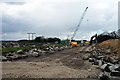
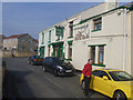

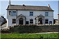
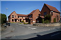
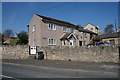
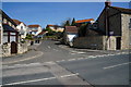
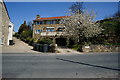
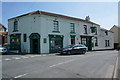
100 photos from this area
Area Information
Key information about the WF11 9GY including its size, population, and administrative classification.
- Area Type
- Postcode
- Area Size
- 1.1 hectares
- Population
- 1810
- Population Density
- 245 people/km²
House Prices in WF11 9GY
24
Properties
£159,640
Average Sold Price
£114,500
Lowest Price
£190,000
Highest Price
Showing 24 properties
| Address | Type | Beds | Baths | Last Sale Price | Last Sale Date | |
|---|---|---|---|---|---|---|
| 2 Waterside, Fairburn, WF11 9GY | Flat | 2 | 2 | £163,000 | Mar 2023 | |
| 5 Waterside, Fairburn, WF11 9GY | Flat | - | - | £135,000 | Nov 2022 | |
| 8 Waterside, Fairburn, WF11 9GY | Flat | 2 | 1 | £150,000 | Mar 2022 | |
| 21 Waterside, Fairburn, WF11 9GY | Flat | 2 | 2 | £155,000 | Dec 2019 | |
| 6 Waterside, Fairburn, WF11 9GY | Flat | 2 | 2 | £114,500 | Jan 2017 | |
| 3 Waterside, Fairburn, WF11 9GY | Flat | - | - | £140,000 | Jan 2012 | |
| 22 Waterside, Fairburn, WF11 9GY | Flat | 3 | 2 | £175,000 | Mar 2009 | |
| 11 Waterside, Fairburn, WF11 9GY | Flat | 2 | 2 | £170,000 | Dec 2008 | |
| 25 Waterside, Fairburn, WF11 9GY | Flat | - | - | £175,000 | Dec 2008 | |
| 9 Waterside, Fairburn, WF11 9GY | Flat | - | - | £145,000 | Feb 2008 |
Page 1 of 3
Energy Efficiency in WF11 9GY
Amenities
Schools
| Rank | School | Type | Entry gender | Ages |
|---|
Explore more schools in this area
Go to Schools tabDemographics
Household Size
One person
most common
Accommodation Type
Houses
most common
Tenure
64
majority
Ethnic Group
White
most common
Religion
N/A
most common
Household Composition
N/A
most common
Age
47
median
Adults (30-64 years)
most common
Household Deprivation
N/A
with no deprivation
NS-SEC
25
in Lower managerial occupations
Explore more demographic insights in this area
Go to Demographics tabPlanning
Planning Constraints
- Flood RiskPremium
- Ramsar Wetland SitesPremium
- Area of Outstanding Natural BeautyPremium
- Protected Nature ReservePremium
- Protected WoodlandPremium