Area Overview for WF11 0DL
Photos of WF11 0DL
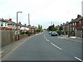
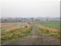

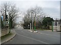
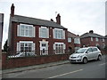
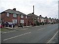
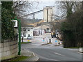
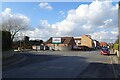
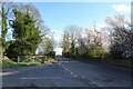
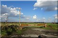
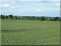
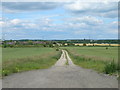
19 photos from this area
Area Information
Key information about the WF11 0DL including its size, population, and administrative classification.
- Area Type
- Postcode
- Area Size
- 4.2 hectares
- Population
- 1411
- Population Density
- 413 people/km²
House Prices in WF11 0DL
41
Properties
£155,318
Average Sold Price
£25,000
Lowest Price
£352,000
Highest Price
Showing 41 properties
| Address | Type | Beds | Baths | Last Sale Price | Last Sale Date | |
|---|---|---|---|---|---|---|
| 67 Womersley Road, Knottingley, WF11 0DL | house | - | - | £226,000 | Apr 2023 | |
| 114 Womersley Road, Knottingley, WF11 0DL | Bungalow | 3 | 1 | £272,000 | Apr 2022 | |
| 64 Womersley Road, Knottingley, WF11 0DL | house | - | - | £325,000 | Dec 2021 | |
| 94 Womersley Road, Knottingley, WF11 0DL | house | - | - | £100,000 | Jun 2021 | |
| 110 Womersley Road, Knottingley, WF11 0DL | Land | 3 | 1 | £352,000 | May 2021 | |
| 66 Womersley Road, Knottingley, WF11 0DL | Bungalow | 2 | 1 | £183,500 | Nov 2019 | |
| 112 Womersley Road, Knottingley, WF11 0DL | Detached | 6 | 2 | £247,500 | Aug 2018 | |
| 74 Womersley Road, Knottingley, WF11 0DL | Terraced | 3 | 1 | £90,000 | May 2017 | |
| 68 Womersley Road, Knottingley, WF11 0DL | Terraced | 4 | 2 | £168,000 | Mar 2016 | |
| 88 Womersley Road, Knottingley, WF11 0DL | Semi-detached | 3 | - | £135,000 | Apr 2014 |
Page 1 of 5
Energy Efficiency in WF11 0DL
Amenities
Schools
| Rank | School | Type | Entry gender | Ages |
|---|
Explore more schools in this area
Go to Schools tabDemographics
Household Size
Two person
most common
Accommodation Type
Houses
most common
Tenure
73
majority
Ethnic Group
White
most common
Religion
N/A
most common
Household Composition
N/A
most common
Age
47
median
Adults (30-64 years)
most common
Household Deprivation
N/A
with no deprivation
NS-SEC
20
in Lower managerial occupations
Explore more demographic insights in this area
Go to Demographics tabPlanning
Planning Constraints
- Flood RiskPremium
- Ramsar Wetland SitesPremium
- Area of Outstanding Natural BeautyPremium
- Protected Nature ReservePremium
- Protected WoodlandPremium