Area Overview for WF10 5GS
Photos of WF10 5GS
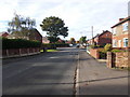
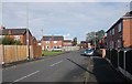
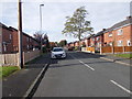
92 photos from this area
Area Information
Key information about the WF10 5GS including its size, population, and administrative classification.
- Area Type
- Postcode
- Area Size
- 2.8 hectares
- Population
- 2369
- Population Density
- 4064 people/km²
House Prices in WF10 5GS
57
Properties
£173,183
Average Sold Price
£62,333
Lowest Price
£288,000
Highest Price
Showing 57 properties
| Address | Type | Beds | Baths | Last Sale Price | Last Sale Date | |
|---|---|---|---|---|---|---|
| 31 Lumley Gardens, Castleford, WF10 5GS | Detached | 4 | 2 | £250,000 | Dec 2023 | |
| 53 Lumley Gardens, Castleford, WF10 5GS | Semi-detached | 3 | 2 | £185,000 | Dec 2023 | |
| 40 Lumley Gardens, Castleford, WF10 5GS | Semi-detached | 3 | 1 | £185,000 | Nov 2022 | |
| 35 Lumley Gardens, Castleford, WF10 5GS | Detached | 4 | 1 | £288,000 | Mar 2022 | |
| 49 Lumley Gardens, Castleford, WF10 5GS | house | - | - | £165,000 | Feb 2021 | |
| 11 Lumley Gardens, Castleford, WF10 5GS | Detached | 3 | 2 | £180,000 | Jun 2020 | |
| 19 Lumley Gardens, Castleford, WF10 5GS | Terraced | 3 | 2 | £134,000 | Mar 2020 | |
| 1 Lumley Gardens, Castleford, WF10 5GS | house | - | - | £229,950 | May 2017 | |
| 52 Lumley Gardens, Castleford, WF10 5GS | Detached | 4 | 2 | £229,950 | Mar 2017 | |
| 55 Lumley Gardens, Castleford, WF10 5GS | Detached | 3 | 2 | £152,950 | Dec 2016 |
Page 1 of 6
Energy Efficiency in WF10 5GS
Amenities
Schools
| Rank | School | Type | Entry gender | Ages |
|---|
Explore more schools in this area
Go to Schools tabDemographics
Household Size
Family (3-5 people)
most common
Accommodation Type
Houses
most common
Tenure
70
majority
Ethnic Group
White
most common
Religion
N/A
most common
Household Composition
N/A
most common
Age
47
median
Adults (30-64 years)
most common
Household Deprivation
N/A
with no deprivation
NS-SEC
30
in Lower managerial occupations
Explore more demographic insights in this area
Go to Demographics tabPlanning
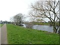
Planning Constraints
- Flood RiskPremium
- Ramsar Wetland SitesPremium
- Area of Outstanding Natural BeautyPremium
- Protected Nature ReservePremium
- Protected WoodlandPremium