Area Overview for WF10 4LX
Photos of WF10 4LX

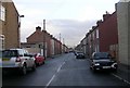
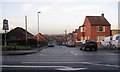
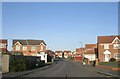
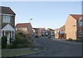
100 photos from this area
Area Information
Key information about the WF10 4LX including its size, population, and administrative classification.
- Area Type
- Postcode
- Area Size
- 4261 m²
- Population
- 1360
- Population Density
- 5815 people/km²
House Prices in WF10 4LX
12
Properties
£81,867
Average Sold Price
£24,500
Lowest Price
£140,000
Highest Price
Showing 12 properties
| Address | Type | Beds | Baths | Last Sale Price | Last Sale Date | |
|---|---|---|---|---|---|---|
| 106 Leeds Road, Glasshoughton, Castleford, WF10 4LX | Terraced | 3 | 1 | £140,000 | Feb 2024 | |
| 104 Leeds Road, Glasshoughton, Castleford, WF10 4LX | Terraced | 3 | 1 | £85,000 | Nov 2023 | |
| 110 Leeds Road, Glasshoughton, Castleford, WF10 4LX | house | 2 | 1 | £90,000 | Sep 2022 | |
| 118 Leeds Road, Glasshoughton, Castleford, WF10 4LX | Terraced | 2 | 1 | £93,000 | Nov 2018 | |
| 108 Leeds Road, Glasshoughton, Castleford, WF10 4LX | Terraced | 2 | 1 | £97,432 | Feb 2008 | |
| 102 Leeds Road, Glasshoughton, Castleford, WF10 4LX | house | - | - | £40,000 | Nov 2005 | |
| 116 Leeds Road, Glasshoughton, Castleford, WF10 4LX | house | - | - | £85,000 | Jun 2005 | |
| 114 Leeds Road, Glasshoughton, Castleford, WF10 4LX | Terraced | - | - | £24,500 | Jul 1995 | |
| 120 Leeds Road, Glasshoughton, Castleford, WF10 4LX | Terraced | - | - | - | - | |
| 112 Leeds Road, Glasshoughton, Castleford, WF10 4LX | Terraced | 2 | 1 | - | - |
Page 1 of 2
Energy Efficiency in WF10 4LX
Amenities
Schools
| Rank | School | Type | Entry gender | Ages |
|---|
Explore more schools in this area
Go to Schools tabDemographics
Household Size
Two person
most common
Accommodation Type
Houses
most common
Tenure
54
majority
Ethnic Group
White
most common
Religion
N/A
most common
Household Composition
N/A
most common
Age
47
median
Adults (30-64 years)
most common
Household Deprivation
N/A
with no deprivation
NS-SEC
24
in Lower managerial occupations
Explore more demographic insights in this area
Go to Demographics tabPlanning
Planning Constraints
- Flood RiskPremium
- Ramsar Wetland SitesPremium
- Area of Outstanding Natural BeautyPremium
- Protected Nature ReservePremium
- Protected WoodlandPremium