Area Overview for WF10 2NT
Photos of WF10 2NT
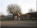
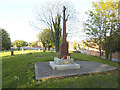
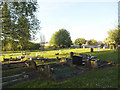
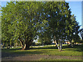
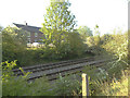
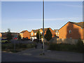
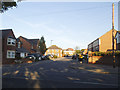
50 photos from this area
Area Information
Key information about the WF10 2NT including its size, population, and administrative classification.
- Area Type
- Postcode
- Area Size
- 1.2 hectares
- Population
- 1599
- Population Density
- 3929 people/km²
House Prices in WF10 2NT
34
Properties
£77,813
Average Sold Price
£24,950
Lowest Price
£135,000
Highest Price
Showing 34 properties
| Address | Type | Beds | Baths | Last Sale Price | Last Sale Date | |
|---|---|---|---|---|---|---|
| 8 Hulme Square, Castleford, WF10 2NT | Semi-detached | 3 | 1 | £135,000 | Jun 2024 | |
| 6 Hulme Square, Castleford, WF10 2NT | Semi-detached | 3 | 1 | £95,000 | Feb 2017 | |
| 7 Hulme Square, Castleford, WF10 2NT | Semi-detached | 3 | - | £83,000 | Dec 2016 | |
| 22 Hulme Square, Castleford, WF10 2NT | Semi-detached | 2 | 1 | £73,500 | Dec 2015 | |
| 28 Hulme Square, Castleford, WF10 2NT | Semi-detached | 3 | - | £100,000 | Oct 2014 | |
| 24 Hulme Square, Castleford, WF10 2NT | Semi-detached | 2 | - | £64,995 | May 2013 | |
| 13 Hulme Square, Castleford, WF10 2NT | Semi-detached | - | - | £89,500 | Nov 2005 | |
| 11 Hulme Square, Castleford, WF10 2NT | Semi-detached | - | - | £62,500 | Aug 2004 | |
| 16 Hulme Square, Castleford, WF10 2NT | Semi-detached | - | - | £82,500 | Jul 2004 | |
| 15 Hulme Square, Castleford, WF10 2NT | Semi-detached | - | - | £45,000 | Aug 2003 |
Page 1 of 4
Energy Efficiency in WF10 2NT
Amenities
Schools
| Rank | School | Type | Entry gender | Ages |
|---|
Explore more schools in this area
Go to Schools tabDemographics
Household Size
Two person
most common
Accommodation Type
Houses
most common
Tenure
40
majority
Ethnic Group
White
most common
Religion
N/A
most common
Household Composition
N/A
most common
Age
47
median
Adults (30-64 years)
most common
Household Deprivation
N/A
with no deprivation
NS-SEC
14
in Lower managerial occupations
Explore more demographic insights in this area
Go to Demographics tabPlanning
Planning Constraints
- Flood RiskPremium
- Ramsar Wetland SitesPremium
- Area of Outstanding Natural BeautyPremium
- Protected Nature ReservePremium
- Protected WoodlandPremium