Area Overview for WF10 2LT
Photos of WF10 2LT
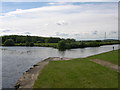
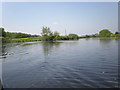
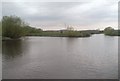
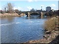

100 photos from this area
Area Information
Key information about the WF10 2LT including its size, population, and administrative classification.
- Area Type
- Postcode
- Area Size
- 1.1 hectares
- Population
- 1672
- Population Density
- 1111 people/km²
House Prices in WF10 2LT
12
Properties
£90,778
Average Sold Price
£58,995
Lowest Price
£135,000
Highest Price
Showing 12 properties
| Address | Type | Beds | Baths | Last Sale Price | Last Sale Date | |
|---|---|---|---|---|---|---|
| 106 Hunt Street Lock Lane, Castleford, WF10 2LT | house | - | - | £120,000 | Jan 2025 | |
| 96 Hunt Street Lock Lane, Castleford, WF10 2LT | Terraced | 3 | 1 | £135,000 | May 2023 | |
| 100 Hunt Street Lock Lane, Castleford, WF10 2LT | Terraced | 3 | 1 | £115,000 | Jul 2021 | |
| 94 Hunt Street Lock Lane, Castleford, WF10 2LT | Terraced | 2 | - | £64,950 | Sep 2016 | |
| 92 Hunt Street Lock Lane, Castleford, WF10 2LT | Terraced | 2 | - | £75,500 | Aug 2015 | |
| 90 Hunt Street Lock Lane, Castleford, WF10 2LT | Terraced | 2 | 1 | £66,000 | Oct 2013 | |
| 104 Hunt Street Lock Lane, Castleford, WF10 2LT | Terraced | - | - | £58,995 | Sep 2003 | |
| 98 Hunt Street Lock Lane, Castleford, WF10 2LT | Terraced | 3 | - | - | - | |
| 102 Hunt Street Lock Lane, Castleford, WF10 2LT | house | - | - | - | - | |
| 88 Hunt Street Lock Lane, Castleford, WF10 2LT | Terraced | - | - | - | - |
Page 1 of 2
Energy Efficiency in WF10 2LT
Amenities
Schools
| Rank | School | Type | Entry gender | Ages |
|---|
Explore more schools in this area
Go to Schools tabDemographics
Household Size
One person
most common
Accommodation Type
Houses
most common
Tenure
60
majority
Ethnic Group
White
most common
Religion
N/A
most common
Household Composition
N/A
most common
Age
47
median
Adults (30-64 years)
most common
Household Deprivation
N/A
with no deprivation
NS-SEC
18
in Lower managerial occupations
Explore more demographic insights in this area
Go to Demographics tabPlanning
Planning Constraints
- Flood RiskPremium
- Ramsar Wetland SitesPremium
- Area of Outstanding Natural BeautyPremium
- Protected Nature ReservePremium
- Protected WoodlandPremium