Area Overview for WF10 2DL
Photos of WF10 2DL


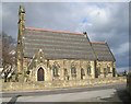

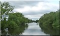
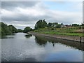
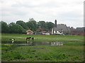

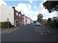
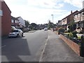

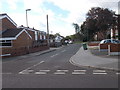
93 photos from this area
Area Information
Key information about the WF10 2DL including its size, population, and administrative classification.
- Area Type
- Postcode
- Area Size
- 5.5 hectares
- Population
- 1600
- Population Density
- 1012 people/km²
House Prices in WF10 2DL
25
Properties
£88,569
Average Sold Price
£18,000
Lowest Price
£190,000
Highest Price
Showing 25 properties
| Address | Type | Beds | Baths | Last Sale Price | Last Sale Date | |
|---|---|---|---|---|---|---|
| 5 Main Street, Allerton Bywater, Castleford, WF10 2DL | Terraced | 2 | 1 | £140,000 | Aug 2025 | |
| 30 Main Street, Allerton Bywater, Castleford, WF10 2DL | Retail | 2 | 1 | £190,000 | Sep 2022 | |
| 19 Main Street, Allerton Bywater, Castleford, WF10 2DL | Terraced | 2 | 1 | £126,000 | Dec 2021 | |
| 13 Main Street, Allerton Bywater, Castleford, WF10 2DL | Terraced | 2 | 1 | £96,000 | Apr 2020 | |
| 34 Main Street, Allerton Bywater, Castleford, WF10 2DL | house | - | - | £115,000 | Jan 2014 | |
| Oakdene, 4 Main Street, Allerton Bywater, Castleford, WF10 2DL | house | - | - | £143,000 | Oct 2012 | |
| 17 Main Street, Allerton Bywater, Castleford, WF10 2DL | house | - | - | £58,000 | Jun 2011 | |
| 32 Main Street, Allerton Bywater, Castleford, WF10 2DL | Semi-detached | - | - | £173,250 | Jan 2008 | |
| 9 Main Street, Allerton Bywater, Castleford, WF10 2DL | Terraced | - | - | £105,000 | Mar 2007 | |
| 16 Main Street, Allerton Bywater, Castleford, WF10 2DL | Detached | - | - | £160,000 | Mar 2003 |
Page 1 of 3
Energy Efficiency in WF10 2DL
Amenities
Schools
| Rank | School | Type | Entry gender | Ages |
|---|
Explore more schools in this area
Go to Schools tabDemographics
Household Size
Two person
most common
Accommodation Type
Houses
most common
Tenure
68
majority
Ethnic Group
White
most common
Religion
N/A
most common
Household Composition
N/A
most common
Age
47
median
Adults (30-64 years)
most common
Household Deprivation
N/A
with no deprivation
NS-SEC
23
in Lower managerial occupations
Explore more demographic insights in this area
Go to Demographics tabPlanning
Planning Constraints
- Flood RiskPremium
- Ramsar Wetland SitesPremium
- Area of Outstanding Natural BeautyPremium
- Protected Nature ReservePremium
- Protected WoodlandPremium