Area Overview for WF1 5SQ
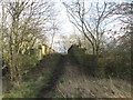
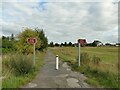
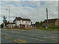
Photos of WF1 5SQ
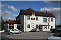
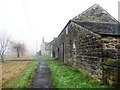
![Junction of Hell Lane and Black Road [the A655] in WF1 5SQ](https://images.propbar.co.uk/images/geograph/16/69/1669803_120.jpg)
25 photos from this area
Area Information
Key information about the WF1 5SQ including its size, population, and administrative classification.
- Area Type
- Postcode
- Area Size
- 2.2 hectares
- Population
- 1465
- Population Density
- 187 people/km²
House Prices in WF1 5SQ
6
Properties
£163,863
Average Sold Price
£152,000
Lowest Price
£175,725
Highest Price
Showing 6 properties
| Address | Type | Beds | Baths | Last Sale Price | Last Sale Date | |
|---|---|---|---|---|---|---|
| 3 West View, Heath, Wakefield, WF1 5SQ | Terraced | 2 | 2 | £152,000 | Feb 2020 | |
| 1 West View, Heath, Wakefield, WF1 5SQ | house | - | - | £175,725 | Nov 2016 | |
| 5 West View, Heath, Wakefield, WF1 5SQ | undefined | - | - | - | - | |
| 7 West View, Heath, Wakefield, WF1 5SQ | Terraced | - | - | - | - | |
| 2 West View, Heath, Wakefield, WF1 5SQ | house | - | - | - | - | |
| The Croft, 4-5 West View, Heath, Wakefield, WF1 5SQ | Terraced | - | - | - | - |
Energy Efficiency in WF1 5SQ
Amenities
Schools
| Rank | School | Type | Entry gender | Ages |
|---|
Explore more schools in this area
Go to Schools tabDemographics
Household Size
Two person
most common
Accommodation Type
Houses
most common
Tenure
59
majority
Ethnic Group
White
most common
Religion
N/A
most common
Household Composition
N/A
most common
Age
47
median
Adults (30-64 years)
most common
Household Deprivation
N/A
with no deprivation
NS-SEC
24
in Lower managerial occupations
Explore more demographic insights in this area
Go to Demographics tabPlanning
Planning Constraints
- Flood RiskPremium
- Ramsar Wetland SitesPremium
- Area of Outstanding Natural BeautyPremium
- Protected Nature ReservePremium
- Protected WoodlandPremium