Area Overview for WF1 5DP
Photos of WF1 5DP

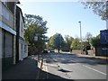
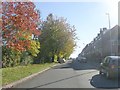
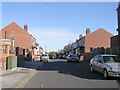
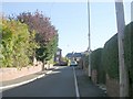
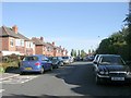
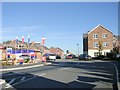
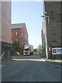
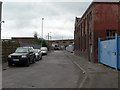
100 photos from this area
Area Information
Key information about the WF1 5DP including its size, population, and administrative classification.
- Area Type
- Postcode
- Area Size
- 1.7 hectares
- Population
- 2585
- Population Density
- 2845 people/km²
House Prices in WF1 5DP
24
Properties
£107,469
Average Sold Price
£34,000
Lowest Price
£220,000
Highest Price
Showing 24 properties
| Address | Type | Beds | Baths | Last Sale Price | Last Sale Date | |
|---|---|---|---|---|---|---|
| 58 Doncaster Road, Wakefield, WF1 5DP | Semi-detached | 3 | 1 | £220,000 | Apr 2024 | |
| 52 Doncaster Road, Wakefield, WF1 5DP | house | - | - | £130,000 | Oct 2019 | |
| 84 Doncaster Road, Wakefield, WF1 5DP | Semi-detached | 3 | 1 | £126,500 | Feb 2018 | |
| 94 Doncaster Road, Wakefield, WF1 5DP | Semi-detached | 3 | 1 | £145,000 | Aug 2017 | |
| 90 Doncaster Road, Wakefield, WF1 5DP | Semi-detached | 3 | - | £116,000 | Sep 2015 | |
| 92 Doncaster Road, Wakefield, WF1 5DP | Semi-detached | 3 | - | £86,500 | Nov 2013 | |
| 66 Doncaster Road, Wakefield, WF1 5DP | house | 3 | - | £98,500 | Jul 2013 | |
| 86 Doncaster Road, Wakefield, WF1 5DP | house | - | - | £119,500 | May 2013 | |
| 62 Doncaster Road, Wakefield, WF1 5DP | house | - | - | £115,000 | Oct 2011 | |
| 82 Doncaster Road, Wakefield, WF1 5DP | Semi-detached | 3 | 1 | £142,500 | Jan 2008 |
Page 1 of 3
Energy Efficiency in WF1 5DP
Amenities
Schools
| Rank | School | Type | Entry gender | Ages |
|---|
Explore more schools in this area
Go to Schools tabDemographics
Household Size
Family (3-5 people)
most common
Accommodation Type
Houses
most common
Tenure
54
majority
Ethnic Group
White
most common
Religion
N/A
most common
Household Composition
N/A
most common
Age
47
median
Adults (30-64 years)
most common
Household Deprivation
N/A
with no deprivation
NS-SEC
24
in Lower managerial occupations
Explore more demographic insights in this area
Go to Demographics tabPlanning
Planning Constraints
- Flood RiskPremium
- Ramsar Wetland SitesPremium
- Area of Outstanding Natural BeautyPremium
- Protected Nature ReservePremium
- Protected WoodlandPremium