Area Overview for WF1 4HH
Photos of WF1 4HH
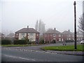
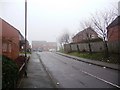
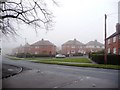
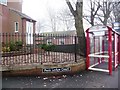

81 photos from this area
Area Information
Key information about the WF1 4HH including its size, population, and administrative classification.
- Area Type
- Postcode
- Area Size
- 2.0 hectares
- Population
- 1629
- Population Density
- 4171 people/km²
House Prices in WF1 4HH
58
Properties
£90,606
Average Sold Price
£15,000
Lowest Price
£125,000
Highest Price
Showing 58 properties
| Address | Type | Beds | Baths | Last Sale Price | Last Sale Date | |
|---|---|---|---|---|---|---|
| 68 Linton Road, Wakefield, WF1 4HH | Terraced | 3 | - | £120,000 | May 2021 | |
| 76 Linton Road, Wakefield, WF1 4HH | house | - | - | £112,500 | Dec 2016 | |
| 72 Linton Road, Wakefield, WF1 4HH | Terraced | 3 | - | £76,000 | Jun 2015 | |
| 84 Linton Road, Wakefield, WF1 4HH | house | 3 | - | £101,000 | Aug 2014 | |
| 64 Linton Road, Wakefield, WF1 4HH | house | - | - | £92,000 | May 2011 | |
| 66 Linton Road, Wakefield, WF1 4HH | Terraced | - | - | £125,000 | May 2007 | |
| 46 Linton Road, Wakefield, WF1 4HH | Semi-detached | 3 | 1 | £109,000 | May 2006 | |
| 56 Linton Road, Wakefield, WF1 4HH | house | - | - | £64,950 | Nov 2003 | |
| 41A Linton Road, Wakefield, WF1 4HH | Flat | - | - | £15,000 | Oct 1997 | |
| 43-A-45-C LINTON ROAD, Wakefield, WF1 4HH | Flat | - | - | - | - |
Page 1 of 6
Energy Efficiency in WF1 4HH
Amenities
Schools
| Rank | School | Type | Entry gender | Ages |
|---|
Explore more schools in this area
Go to Schools tabDemographics
Household Size
One person
most common
Accommodation Type
Houses
most common
Tenure
42
majority
Ethnic Group
White
most common
Religion
N/A
most common
Household Composition
N/A
most common
Age
47
median
Adults (30-64 years)
most common
Household Deprivation
N/A
with no deprivation
NS-SEC
14
in Lower managerial occupations
Explore more demographic insights in this area
Go to Demographics tabPlanning
Planning Constraints
- Flood RiskPremium
- Ramsar Wetland SitesPremium
- Area of Outstanding Natural BeautyPremium
- Protected Nature ReservePremium
- Protected WoodlandPremium