Area Overview for WF1 2AL
Photos of WF1 2AL

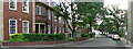


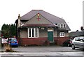
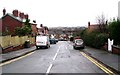
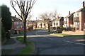

100 photos from this area
Area Information
Key information about the WF1 2AL including its size, population, and administrative classification.
- Area Type
- Postcode
- Area Size
- 1.8 hectares
- Population
- 1715
- Population Density
- 93772 people/km²
House Prices in WF1 2AL
30
Properties
£214,698
Average Sold Price
£64,950
Lowest Price
£310,000
Highest Price
Showing 30 properties
| Address | Type | Beds | Baths | Last Sale Price | Last Sale Date | |
|---|---|---|---|---|---|---|
| 12 Whitehall Rise, Wakefield, WF1 2AL | Bungalow | 3 | 2 | £300,000 | Mar 2025 | |
| 3 Whitehall Rise, Wakefield, WF1 2AL | Bungalow | 2 | 2 | £305,000 | Mar 2024 | |
| 26 Whitehall Rise, Wakefield, WF1 2AL | Bungalow | - | - | £310,000 | Oct 2023 | |
| 6 Whitehall Rise, Wakefield, WF1 2AL | Semi-detached | 2 | 1 | £215,000 | Nov 2022 | |
| 14 Whitehall Rise, Wakefield, WF1 2AL | Retail | 2 | 1 | £193,000 | Jun 2022 | |
| 31 Whitehall Rise, Wakefield, WF1 2AL | Bungalow | - | - | £255,000 | Sep 2021 | |
| 9 Whitehall Rise, Wakefield, WF1 2AL | Bungalow | 3 | 1 | £260,000 | Sep 2021 | |
| 15 Whitehall Rise, Wakefield, WF1 2AL | Semi-detached | 2 | 1 | £195,000 | Nov 2020 | |
| 23 Whitehall Rise, Wakefield, WF1 2AL | Bungalow | 2 | 3 | £245,000 | Dec 2019 | |
| 8 Whitehall Rise, Wakefield, WF1 2AL | Bungalow | 2 | 1 | £224,000 | May 2019 |
Page 1 of 3
Energy Efficiency in WF1 2AL
Amenities
Schools
| Rank | School | Type | Entry gender | Ages |
|---|
Explore more schools in this area
Go to Schools tabDemographics
Household Size
Two person
most common
Accommodation Type
Houses
most common
Tenure
73
majority
Ethnic Group
White
most common
Religion
N/A
most common
Household Composition
N/A
most common
Age
47
median
Adults (30-64 years)
most common
Household Deprivation
N/A
with no deprivation
NS-SEC
26
in Lower managerial occupations
Explore more demographic insights in this area
Go to Demographics tabPlanning
Planning Constraints
- Flood RiskPremium
- Ramsar Wetland SitesPremium
- Area of Outstanding Natural BeautyPremium
- Protected Nature ReservePremium
- Protected WoodlandPremium