Area Overview for WF1 2AA
Photos of WF1 2AA
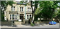
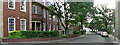
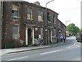


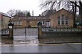
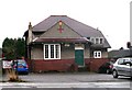
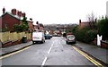
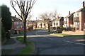

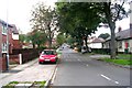
100 photos from this area
Area Information
Key information about the WF1 2AA including its size, population, and administrative classification.
- Area Type
- Postcode
- Area Size
- 1.3 hectares
- Population
- 1715
- Population Density
- 4889 people/km²
House Prices in WF1 2AA
22
Properties
£295,481
Average Sold Price
£85,000
Lowest Price
£590,000
Highest Price
Showing 22 properties
| Address | Type | Beds | Baths | Last Sale Price | Last Sale Date | |
|---|---|---|---|---|---|---|
| 73 Bradford Road, Wakefield, WF1 2AA | Semi-detached | 4 | 2 | £451,382 | Sep 2023 | |
| REAR 53, BRADFORD ROAD, Wakefield, WF1 2AA | Unknown | - | - | £150,000 | Sep 2021 | |
| 53A Bradford Road, Wakefield, WF1 2AA | Flat | - | - | £150,000 | Sep 2021 | |
| 83 Bradford Road, Wakefield, WF1 2AA | Semi-detached | 3 | 2 | £317,950 | Dec 2019 | |
| 81 Bradford Road, Wakefield, WF1 2AA | Detached | 5 | 2 | £590,000 | Jun 2016 | |
| 71 Bradford Road, Wakefield, WF1 2AA | Semi-detached | 5 | - | £260,000 | Feb 2016 | |
| 85 Bradford Road, Wakefield, WF1 2AA | Semi-detached | 4 | - | £230,000 | Oct 2012 | |
| 87 Bradford Road, Wakefield, WF1 2AA | Detached | - | - | £425,000 | Sep 2009 | |
| 55 Bradford Road, Wakefield, WF1 2AA | Detached | 4 | 2 | £85,000 | Mar 2000 | |
| 47-51-A BRADFORD ROAD, Wakefield, WF1 2AA | Terraced | - | - | - | - |
Page 1 of 3
Energy Efficiency in WF1 2AA
Amenities
Schools
| Rank | School | Type | Entry gender | Ages |
|---|
Explore more schools in this area
Go to Schools tabDemographics
Household Size
Two person
most common
Accommodation Type
Houses
most common
Tenure
73
majority
Ethnic Group
White
most common
Religion
N/A
most common
Household Composition
N/A
most common
Age
47
median
Adults (30-64 years)
most common
Household Deprivation
N/A
with no deprivation
NS-SEC
26
in Lower managerial occupations
Explore more demographic insights in this area
Go to Demographics tabPlanning
Planning Constraints
- Flood RiskPremium
- Ramsar Wetland SitesPremium
- Area of Outstanding Natural BeautyPremium
- Protected Nature ReservePremium
- Protected WoodlandPremium