Area Overview for WF1 1UQ
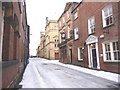
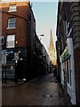
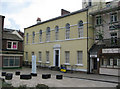
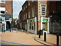
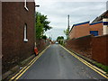
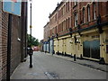
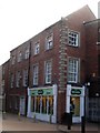
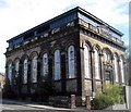
Photos of WF1 1UQ


Area Information
Living in WF1 1UQ means residing in a very specific residential cluster defined by a single postcode. This small area covers just 744 square metres and holds a population of 2,868 residents. The density here is exceptionally high, registering at 3,857,194 people per square kilometre when calculated against the available figure. This concentration suggests a tight-knit neighbourhood rather than a sprawling suburb. You are buying into a contained environment where everyday life revolves around the immediate vicinity of your home. The postcode serves as the primary identifier for this distinct neighbourhood within Wakefield. While the physical footprint is minute, the community presence is significant. Prospective buyers should understand that 'WF1 1UQ' represents a precise geographic slice of the wider region, not a broad borough. Daily life is characterised by proximity, as the entire community lives within a very restricted boundary.
- Area Type
- Postcode
- Area Size
- 744 m²
- Population
- 2868
- Population Density
- 4336 people/km²
The property market in WF1 1UQ is characterised by a predominance of houses. This structural distinction sets it apart from areas where flats or bungalows might dominate the skyline. With 39% of residents owning their homes, you can expect a mixed housing stock where both owner-occupied and rental properties coexist. A majority of the 2,868 residents do not own their dwellings, suggesting a significant section of the rental market operates within this small cluster. Given the limited area size of 744 square metres, the number of individual properties is likely constrained relative to the population figure. Buyers looking at homes in WF1 1UQ should anticipate a local environment where houses are the main building style. TheOwner-occupancy rate is below half, which often indicates a location accessible through both the private ladder and the rental sector. This balance offers flexibility for different types of moving buyers but also means competition may arise from both first-time purchases and tenant movers.
House Prices in WF1 1UQ
Showing 19 properties
| Address | Type | Beds | Baths | Last Sale Price | Last Sale Date | |
|---|---|---|---|---|---|---|
| 5 George And Crown Yard, Wakefield, WF1 1UQ | Industrial | - | - | - | - | |
| Elliotts Bar, Old Auction Rooms, 5 George And Crown Yard, Wakefield, WF1 1UQ | Office | - | - | - | - | |
| Holroyd Miller Property Specialists, 5 George And Crown Yard, Wakefield, WF1 1UQ | Industrial | - | - | - | - | |
| 4 George And Crown Yard, Wakefield, WF1 1UQ | Industrial | - | - | - | - | |
| Red Bar Public House, 3 George And Crown Yard, Wakefield, WF1 1UQ | restaurant_cafe | - | - | - | - | |
| Flat E, 1 George And Crown Yard, Wakefield, WF1 1UQ | Flat | - | - | - | - | |
| Flat C, 1 George And Crown Yard, Wakefield, WF1 1UQ | Flat | - | - | - | - | |
| Flat B, 1 George And Crown Yard, Wakefield, WF1 1UQ | Flat | - | - | - | - | |
| Flat 4, 2A George And Crown Yard, Wakefield, WF1 1UQ | Flat | - | - | - | - | |
| Flat D, 1 George And Crown Yard, Wakefield, WF1 1UQ | Flat | - | - | - | - |
Energy Efficiency in WF1 1UQ
Convenience lies at the heart of living in WF1 1UQ, with key amenities within practical reach of every resident. You have direct access to major retailers including M&S Wakefield, Morrisons Wakefield, and Iceland Wakefield. These five retail outlets satisfy daily shopping needs ranging from groceries to general merchandise without requiring long commutes. Transport links are equally accessible, with five railway stations nearby. Wakefield Westgate Railway Station, Wakefield Kirkgate Railway Station, and Sandal & Agbrigg Railway Station provide the broader national rail network. These stations connect you to wider travel destinations efficiently. The presence of these major chains and transport hubs defines the character of the area as a well-served residential zone. Everyday life benefits from the immediate availability of supermarkets and the option for quick train journeys. This infrastructure supports a lifestyle where essential services are always a short drive away.
Amenities
Schools
| Rank | School | Type | Entry gender | Ages |
|---|
Explore more schools in this area
Go to Schools tabDemographics
The community in WF1 1UQ is dominated by adults aged between 30 and 64 years. This middle-aged demographic shapes the vibe of the neighbourhood, indicating a resident base likely focused on stability and family life. The median age for residents stands at 47 years, reinforcing the finding that younger households and very elderly pensioners make up a smaller portion of the total. Home ownership is modest, with only 39% of residents owning their homes outright. This implies that a majority of the population rents their accommodation or is living in properties they do not own. Houses form the predominant structural type of accommodation in this high-density cluster. You will find that the ethnic composition is overwhelmingly White. This demographic profile provides a clear picture of who calls this specific postcode area their home, influencing local schools, community groups, and daily social interactions.
Household Size
Accommodation Type
Tenure
Ethnic Group
Religion
Household Composition
Age
Household Deprivation
NS-SEC
Explore more demographic insights in this area
Go to Demographics tabPlanning
Planning Constraints
- Flood RiskPremium
- Ramsar Wetland SitesPremium
- Area of Outstanding Natural BeautyPremium
- Protected Nature ReservePremium
- Protected WoodlandPremium