Area Overview for WF1 1DL
Photos of WF1 1DL
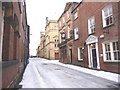
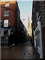
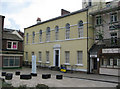
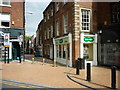
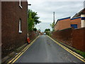
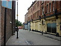
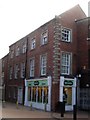
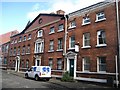
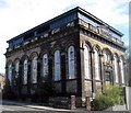
100 photos from this area
Area Information
Key information about the WF1 1DL including its size, population, and administrative classification.
- Area Type
- Postcode
- Area Size
- 5531 m²
- Population
- 1214
- Population Density
- 5365 people/km²
House Prices in WF1 1DL
17
Properties
-
Average Sold Price
-
Lowest Price
-
Highest Price
Showing 17 properties
| Address | Type | Beds | Baths | Last Sale Price | Last Sale Date | |
|---|---|---|---|---|---|---|
| Pre School, New Life Christian Centre, George Street, Wakefield, WF1 1DL | Industrial | - | - | - | - | |
| Air Training Corps, George Street, Wakefield, WF1 1DL | Flat | - | - | - | - | |
| Drill Hall House, George Street, Wakefield, WF1 1DL | Terraced | - | - | - | - | |
| Lindleys, 70 George Street, Wakefield, WF1 1DL | office_workshop | - | - | - | - | |
| The Polka Hop, 60 George Street, Wakefield, WF1 1DL | Leisure | - | - | - | - | |
| Basement, 35-39 George Street, Wakefield, WF1 1DL | Office | - | - | - | - | |
| Suite 12, 35-39 George Street, Wakefield, WF1 1DL | Office | - | - | - | - | |
| Suite 16, 35-39 George Street, Wakefield, WF1 1DL | Office | - | - | - | - | |
| Suite 17, 35-39 George Street, Wakefield, WF1 1DL | Office | - | - | - | - | |
| Suite 3, 35-39 George Street, Wakefield, WF1 1DL | Office | - | - | - | - |
Page 1 of 2
Energy Efficiency in WF1 1DL
Amenities
Schools
| Rank | School | Type | Entry gender | Ages |
|---|
Explore more schools in this area
Go to Schools tabDemographics
Household Size
One person
most common
Accommodation Type
Flats
most common
Tenure
8
majority
Ethnic Group
White
most common
Religion
N/A
most common
Household Composition
N/A
most common
Age
47
median
Adults (30-64 years)
most common
Household Deprivation
N/A
with no deprivation
NS-SEC
17
in Lower managerial occupations
Explore more demographic insights in this area
Go to Demographics tabPlanning
Planning Constraints
- Flood RiskPremium
- Ramsar Wetland SitesPremium
- Area of Outstanding Natural BeautyPremium
- Protected Nature ReservePremium
- Protected WoodlandPremium