Area Overview for Wakefield
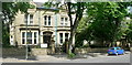
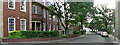
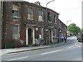
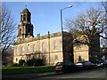
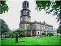
Photos of Wakefield


Area Information
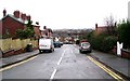
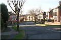
Wakefield is a built-up area in England covering 27.7 km², with a population of 37,116 people. The density here is 1,339 people per km², creating an urban environment typical of a working-class city. Residents live in a compact city where daily life centres on local community hubs and established neighbourhoods. This area represents a significant portion of the West Yorkshire region, offering a sense of familiarity for locals. You will find a community defined by its historical roots and its role as a regional centre. Living in Wakefield means experiencing a city that balances urban convenience with a tighter-knit feel compared to major metropolitan hubs. The city infrastructure supports high population numbers within a relatively small geographic footprint. Families and individuals navigate this space through a network of streets that have evolved over centuries. You can expect a routine where local shops and public transport routes play a central role. The area stands as a distinct district with its own rhythm and character, separate from the wider countryside that surrounds it.
- Area Type
- Built Up Area 250
- Area Size
- 27.7 km²
- Population
- 37116
- Population Density
- 1339 people/km²
Your daily lifestyle in Wakefield revolves around amenities within practical reach. Five railway stations serve the area, including Wakefield Westgate Railway Station, Wakefield Kirkgate Railway Station, and Sandal & Agbrigg Railway Station. These stations provide links to the wider rail network for travel outside the city. Shopping options include Spar Wentworth, M & S Wakefield, and Asda Living, ensuring you have access to supermarkets and daily necessities. These notable retailers are located across the city for your convenience. Living in Wakefield means you can walk to or drive to these specific venues for your weekly grocery run. The retail sector across the city caters to the needs of the local population. You do not need to travel a long distance for basic shopping or dining. The proximity of these five railway hubs and five major retail points creates a self-sufficient urban environment. Daily life is streamlined by having these services located within the city bounds. The character of the area is defined by this accessible mix of transport links and retail outlets.
Amenities
Schools
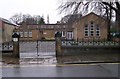
Families living in Wakefield have access to a variety of educational institutions within the immediate vicinity. Stanley Nursery School and Greenhill Nursery School serve the very young residents. These nurseries provide early childcare options for parents working nearby. Primary education is supported by Stanley Grove Primary and Nursery School and Lofthouse Gate Primary School. These schools offer foundational schooling for children growing up in the city. For older children requiring secondary or community education, Newton Hill Community Primary School is available with a good Ofsted rating. This rating indicates a standard of education that meets regulatory expectations. The mix of nurseries and primary schools covers the early years of a child's development. You will find institutions named Stanley, Greenhill, and Lofthouse integrated into the local playbook. This selection means you do not need to travel far for initial education. The presence of a school with a good rating provides reassurance regarding educational quality. However, the list focuses on nursery and primary stages, indicating specific zones within the city have these facilities.
| Rank | School | Type | Entry gender | Ages |
|---|
Explore more schools in this area
Go to Schools tabDemographics
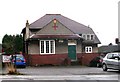
The community in Wakefield is dominated by an older population, with a median age of 70 years. This demographic profile indicates a significant presence of retirees living in homes across the city. Households are predominantly owned, with a 62% home ownership rate standing out as a key statistic for potential buyers. This high level of ownership suggests stability within the communities you might join. The accommodation types reflect this settled population, focusing on properties suitable for long-term residence rather than short-term lets. You are looking at an area where residents have put down roots, evidenced by the majority buying their homes rather than renting. Diversity and ethnic makeup are part of the city's fabric, though specific group breakdowns are not detailed in the current records. Religious affiliations follow similar patterns of established communities. Understanding this age profile and ownership structure helps you grasp the lifestyle prevalent here. You will likely interact with neighbours who have called this place home for decades. The community feel is rooted in these long-term residents who shape the local culture.