Area Overview for Hemsworth
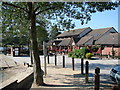
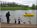
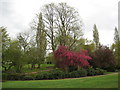
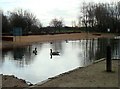
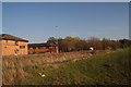
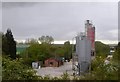
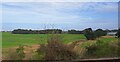
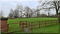
Photos of Hemsworth
Area Information
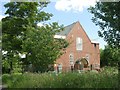
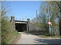
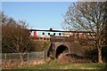
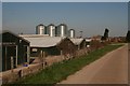
Living in Hemsworth offers a distinct character within the Wakefield district of West Yorkshire. This civil parish spans 16.8 km² and holds a population of 1,626 people. You are stepping into a location with deep historical roots, first mentioned in the Domesday Book of 1086 as Hemeleswrde. The area was originally an agricultural village before coal mining dominated its development from the late 19th century onwards. Today, the settlement sits approximately 7.75 miles south-east of Wakefield, positioned conveniently near the Wakefield and Doncaster railway line. Your daily life here centres on the unique blend of ancient heritage and quiet modern living. The town features St Helen's Church, a landmark dating back as far as the 11th or 12th century, which sits alongside Archbishop Holgate Hospital. This almshouse foundation was originally founded in 1555 and now operates as a group of 24 cottages managing significant assets. While the local economy has shifted from its industrial past, the parish maintains a steady population density of 97 people per square kilometre. Settlement remains faithful to its history, with a market town heritage and a strong connection to the surrounding countryside. The area does not possess protected nature reserves or Ramsar wetland sites, which influences local planning in ways specific to this parish. You will find a setting where history is preserved without the heavy restrictions of major conservation designations, making it a straightforward choice for those seeking historical charm with local autonomy.
- Area Type
- Parish
- Area Size
- 16.8 km²
- Population
- 1626
- Population Density
- 97 people/km²
Demographics
The community profile of Hemsworth reflects a settled population with a notably mature age structure. The median age for residents is 70 years old, indicating that a significant portion of the neighbourhood consists of older adults. While data on specific age ranges is aggregated under a total category, the high median age suggests you are likely dealing with residents who have stayed in the area for many years. This demographic reality shapes the local energy and services, creating an environment less focused on young families and more on established households. Home ownership stands as a defining feature of this neighbourhood, with 57% of residents owning their properties outright or with a mortgage. This majority suggests a stable community where people have invested deeply in their local homes. Accommodation type data is recorded generally, but the high ownership rate strongly points towards a stock dominated by traditional family homes rather than rental flats or modern apartments. The parish does not currently report specific data on predominant ethnic groups or religious affiliations, yet the long-term history of the area, including the presence of almshouses founded centuries ago, hints at a historically consistent community fabric. With a population density of 97 people per square kilometre, the area feels intimate rather than sprawling. You are entering a space defined by continuity, where households have maintained ownership and residence across changing economic eras. This creates a predictable social environment, ideal for those who value established roots over rapid demographic shifts.
Household Size
Accommodation Type
Tenure
Ethnic Group
Religion
Household Composition
Age
Household Deprivation
NS-SEC
Explore more demographic insights in this area
Go to Demographics tabPlanning
Planning Constraints
- Flood RiskPremium
- Ramsar Wetland SitesPremium
- Area of Outstanding Natural BeautyPremium
- Protected Nature ReservePremium
- Protected WoodlandPremium