Area Overview for TS9 7BW
Photos of TS9 7BW
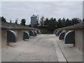
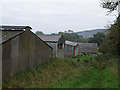
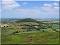
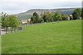
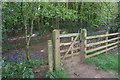
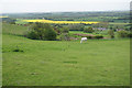
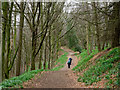
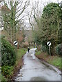
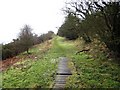
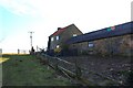
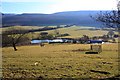
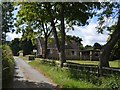
24 photos from this area
Area Information
Key information about the TS9 7BW including its size, population, and administrative classification.
- Area Type
- Postcode
- Area Size
- 9.7 hectares
- Population
- 1732
- Population Density
- 15 people/km²
House Prices in TS9 7BW
19
Properties
£402,906
Average Sold Price
£123,500
Lowest Price
£760,000
Highest Price
Showing 19 properties
| Address | Type | Beds | Baths | Last Sale Price | Last Sale Date | |
|---|---|---|---|---|---|---|
| Verdun House, Bank Lane, Faceby, TS9 7BW | Detached | 5 | 3 | £760,000 | Oct 2024 | |
| Rosegarth, Bank Lane, Faceby, TS9 7BW | Bungalow | - | - | £280,751 | Apr 2024 | |
| Bank Side, Faceby To Goulton Lane, Faceby, TS9 7BW | Bungalow | 4 | 2 | £545,000 | Nov 2020 | |
| Faceby House, Bank Lane, Faceby, TS9 7BW | Semi-detached | 4 | - | £500,000 | Aug 2014 | |
| Achanlochy, Bank Lane, Faceby, TS9 7BW | house | - | - | £465,000 | Oct 2010 | |
| Copperty Keld, Faceby To Goulton Lane, Faceby, TS9 7BW | Detached | - | - | £396,000 | Dec 2007 | |
| The Little Cottage, Bank Lane, Faceby, TS9 7BW | Detached | - | - | £153,000 | Oct 2004 | |
| Pheasant Rise, Bank Lane, Faceby, TS9 7BW | Detached | - | - | £123,500 | Aug 1996 | |
| House On The Hill, Bank Lane, Faceby, TS9 7BW | Detached | 4 | 3 | - | - | |
| Charlice, Bank Lane, Faceby, TS9 7BW | Detached | - | - | - | - |
Page 1 of 2
Energy Efficiency in TS9 7BW
Amenities
Schools
| Rank | School | Type | Entry gender | Ages |
|---|
Explore more schools in this area
Go to Schools tabDemographics
Household Size
Two person
most common
Accommodation Type
Houses
most common
Tenure
76
majority
Ethnic Group
White
most common
Religion
N/A
most common
Household Composition
N/A
most common
Age
47
median
Adults (30-64 years)
most common
Household Deprivation
N/A
with no deprivation
NS-SEC
44
in Lower managerial occupations
Explore more demographic insights in this area
Go to Demographics tabPlanning
Planning Constraints
- Flood RiskPremium
- Ramsar Wetland SitesPremium
- Area of Outstanding Natural BeautyPremium
- Protected Nature ReservePremium
- Protected WoodlandPremium