Area Overview for TS9 5BJ
Photos of TS9 5BJ
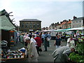
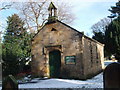
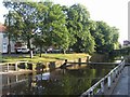
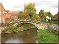
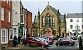
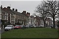
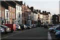
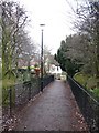
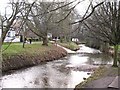
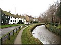
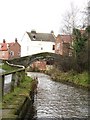
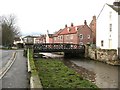
100 photos from this area
Area Information
Key information about the TS9 5BJ including its size, population, and administrative classification.
- Area Type
- Postcode
- Area Size
- 2780 m²
- Population
- 1579
- Population Density
- 87 people/km²
House Prices in TS9 5BJ
19
Properties
£195,231
Average Sold Price
£42,500
Lowest Price
£485,000
Highest Price
Showing 19 properties
| Address | Type | Beds | Baths | Last Sale Price | Last Sale Date | |
|---|---|---|---|---|---|---|
| 10 Levenside, Stokesley, TS9 5BJ | Terraced | 2 | 2 | £325,000 | Oct 2025 | |
| 18A Levenside, Stokesley, TS9 5BJ | house | 1 | - | £165,000 | Mar 2025 | |
| 18 Levenside, Stokesley, TS9 5BJ | Flat | 1 | - | £146,000 | Jan 2025 | |
| Burnside, 16A Levenside, Stokesley, TS9 5BJ | Bungalow | 1 | 1 | £187,500 | Aug 2024 | |
| 8 Levenside, Stokesley, TS9 5BJ | Terraced | 1 | 1 | £145,000 | Oct 2022 | |
| 6 Levenside, Stokesley, TS9 5BJ | Terraced | 2 | 1 | £165,000 | Jul 2022 | |
| The Old Granary, 10A Levenside, Stokesley, TS9 5BJ | house | - | - | £485,000 | Mar 2019 | |
| 16 Levenside, Stokesley, TS9 5BJ | house | - | - | £192,000 | Feb 2019 | |
| 4 Levenside, Stokesley, TS9 5BJ | house | - | - | £130,000 | Jan 2016 | |
| Beck House, 2A Levenside, Stokesley, TS9 5BJ | house | 3 | - | £300,000 | Oct 2012 |
Page 1 of 2
Energy Efficiency in TS9 5BJ
Amenities
Schools
| Rank | School | Type | Entry gender | Ages |
|---|
Explore more schools in this area
Go to Schools tabDemographics
Household Size
Two person
most common
Accommodation Type
Houses
most common
Tenure
79
majority
Ethnic Group
White
most common
Religion
N/A
most common
Household Composition
N/A
most common
Age
47
median
Adults (30-64 years)
most common
Household Deprivation
N/A
with no deprivation
NS-SEC
45
in Lower managerial occupations
Explore more demographic insights in this area
Go to Demographics tabPlanning
Planning Constraints
- Flood RiskPremium
- Ramsar Wetland SitesPremium
- Area of Outstanding Natural BeautyPremium
- Protected Nature ReservePremium
- Protected WoodlandPremium