Area Overview for TS15 0JU
Photos of TS15 0JU
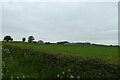

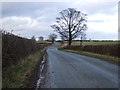
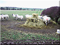
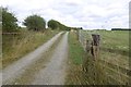
10 photos from this area
Area Information
Key information about the TS15 0JU including its size, population, and administrative classification.
- Area Type
- Postcode
- Area Size
- 2.5 km²
- Population
- 2366
- Population Density
- 78 people/km²
House Prices in TS15 0JU
8
Properties
£706,350
Average Sold Price
£450,000
Lowest Price
£1,200,000
Highest Price
Showing 8 properties
| Address | Type | Beds | Baths | Last Sale Price | Last Sale Date | |
|---|---|---|---|---|---|---|
| Indian Farm, Road From Middleton Road To Middleton On Leven, Middleton On Leven, TS15 0JU | Equestrian | 4 | 2 | £1,200,000 | Feb 2023 | |
| Foxton Lodge Farm, Weary Bank To Foxton Lodge, Middleton On Leven, TS15 0JU | Detached | - | - | £450,000 | Aug 2017 | |
| Goslingmire Farm, Road From Middleton Road To Middleton On Leven, Middleton On Leven, TS15 0JU | Detached | - | - | £469,050 | Mar 2015 | |
| Spyknave Hill Farm, Spyknave Hill Track, Middleton On Leven, TS15 0JU | Detached | - | - | - | - | |
| Middleton Grange Farm, Road From Middleton Road To Middleton On Leven, Middleton On Leven, TS15 0JU | Detached | - | - | - | - | |
| Grange Lea, Road From Middleton Road To Middleton On Leven, Middleton On Leven, TS15 0JU | house | - | - | - | - | |
| Middleton Grove Farm, Road From Middleton Road To Middleton On Leven, Middleton On Leven, TS15 0JU | Detached | - | - | - | - | |
| Hutton View, Road From Middleton Road To Middleton On Leven, Middleton On Leven, TS15 0JU | Detached | - | - | - | - |
Energy Efficiency in TS15 0JU
Amenities
Schools
| Rank | School | Type | Entry gender | Ages |
|---|
Explore more schools in this area
Go to Schools tabDemographics
Household Size
Two person
most common
Accommodation Type
Houses
most common
Tenure
82
majority
Ethnic Group
White
most common
Religion
N/A
most common
Household Composition
N/A
most common
Age
47
median
Adults (30-64 years)
most common
Household Deprivation
N/A
with no deprivation
NS-SEC
49
in Lower managerial occupations
Explore more demographic insights in this area
Go to Demographics tabPlanning
Planning Constraints
- Flood RiskPremium
- Ramsar Wetland SitesPremium
- Area of Outstanding Natural BeautyPremium
- Protected Nature ReservePremium
- Protected WoodlandPremium