Area Overview for TS13 5BU
Photos of TS13 5BU
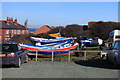
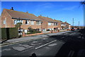
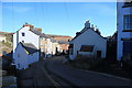
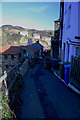
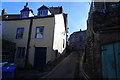
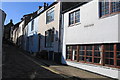
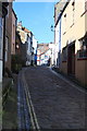
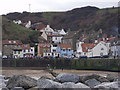
100 photos from this area
Area Information
Key information about the TS13 5BU including its size, population, and administrative classification.
- Area Type
- Postcode
- Area Size
- 6184 m²
- Population
- 1972
- Population Density
- 60 people/km²
House Prices in TS13 5BU
31
Properties
£169,433
Average Sold Price
£35,000
Lowest Price
£535,000
Highest Price
Showing 31 properties
| Address | Type | Beds | Baths | Last Sale Price | Last Sale Date | |
|---|---|---|---|---|---|---|
| The Cottage, Beckside, Staithes, TS13 5BU | house | - | - | £222,500 | Nov 2025 | |
| Pilot Me Cottage, Beckside, Staithes, TS13 5BU | Detached | 3 | 3 | £535,000 | Jul 2023 | |
| Buttress Cottage, Beckside, Staithes, TS13 5BU | Maisonette | - | - | £240,000 | May 2023 | |
| 2 Beckside, Staithes, TS13 5BU | house | - | - | £190,000 | Jan 2023 | |
| Fordside, Beckside, Staithes, TS13 5BU | Terraced | - | - | £185,000 | Aug 2020 | |
| Bellebeck, Beckside, Staithes, TS13 5BU | house | - | - | £220,750 | Nov 2019 | |
| Slipway, Beckside, Staithes, TS13 5BU | Terraced | 2 | - | £156,000 | Feb 2016 | |
| The Boiling House, Beckside, Staithes, TS13 5BU | Cottage | 2 | 1 | £185,000 | Apr 2015 | |
| Star Of Hope Cottage, Beckside, Staithes, TS13 5BU | house | - | - | £162,500 | Nov 2014 | |
| The Stables, Beckside, Staithes, TS13 5BU | house | - | - | £162,252 | Nov 2009 |
Page 1 of 4
Energy Efficiency in TS13 5BU
Amenities
Schools
| Rank | School | Type | Entry gender | Ages |
|---|
Explore more schools in this area
Go to Schools tabDemographics
Household Size
Two person
most common
Accommodation Type
Houses
most common
Tenure
67
majority
Ethnic Group
White
most common
Religion
N/A
most common
Household Composition
N/A
most common
Age
47
median
Adults (30-64 years)
most common
Household Deprivation
N/A
with no deprivation
NS-SEC
25
in Lower managerial occupations
Explore more demographic insights in this area
Go to Demographics tabPlanning
Planning Constraints
- Flood RiskPremium
- Ramsar Wetland SitesPremium
- Area of Outstanding Natural BeautyPremium
- Protected Nature ReservePremium
- Protected WoodlandPremium