Area Overview for Tranby Ward
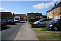
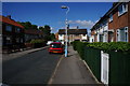
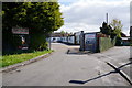
Photos of Tranby Ward

Area Information
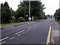
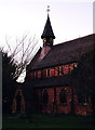
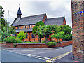
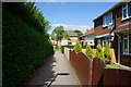
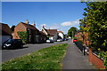
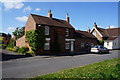
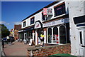
Tranby Ward sits within the Borough of Cannock Chase in Staffordshire, covering a compact footprint of just 5.1 square kilometres. This district represents a settled residential locale where daily life revolves around established neighbourhoods rather than rapid urban expansion. The area is defined by its mature composition, with a median age of seventy years suggesting a community anchored by older residents. You will find a population that is generally retired or semi-retired, preferring a quieter existence over the pace of a metropolitan centre. Living in Tranby Ward means adapting to an environment built for older generations, where the built stock and local culture cater to this specific demographic. The ward functions as a self-contained unit within the borough structure, offering residents a defined sense of place. While the area lacks the density of city centres, it provides a slow rhythm where the main activities revolve around local amenities and community maintenance. Prospective buyers should recognise that Tranby Ward is a specialised market dominated by older households and a stable property history. The small geographical size means that distance to services is minimal, yet the character of the area is distinctly one of age and tradition. Anyone considering homes in Tranby Ward must appreciate this specific social fabric before committing to a purchase.
- Area Type
- District Borough Unitary Ward
- Area Size
- 5.1 km²
- Population
- Not available
- Population Density
- Not available
Demographics
The community in Tranby Ward displays a very distinct age profile with a median age of seventy. This figure indicates that half of the population is older than seventy, confirming the area is dominated by the senior demographic. Most common age statistics highlight that the total population skews heavily towards older residents compared to the national average. You can expect a neighbourhood where daily interactions likely centre around retirement communities, pension clubs, and local healthcare facilities. Home ownership stands at a high seventy-five per cent, which is a significant proportion for district-level statistics in the UK. This level of ownership suggests long-term residency and stability within the ward. Households are primarily composed of the total population base without a significant presence of young families renting apartments or flats. The demographics point to a consistent community where residents have lived for decades rather than transient populations. Unlike areas with high student populations or young professional growth, Tranby Ward remains static in its social makeup. Deprivation figures are not the primary focus here as the data reflects a well-secured housing stock rather than a struggling market. The diversity and religion statistics do not break down specific groups in the available records, so the prevailing narrative remains one of homogeneity. Living in Tranby Ward means joining a demographic where life stages align with retirement and established routines.
Household Size
Accommodation Type
Tenure
Ethnic Group
Religion
Household Composition
Age
Household Deprivation
NS-SEC
Explore more demographic insights in this area
Go to Demographics tabPlanning
Planning Constraints
- Flood RiskPremium
- Ramsar Wetland SitesPremium
- Area of Outstanding Natural BeautyPremium
- Protected Nature ReservePremium
- Protected WoodlandPremium