Area Overview for Todmorden
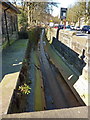
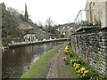
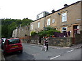
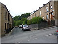
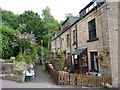
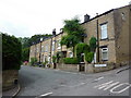
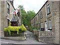
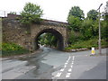
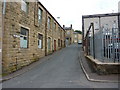
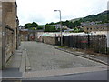
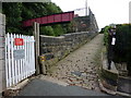
Photos of Todmorden

Area Information
Todmorden is a built-up area spanning 3.7 km², situated in England. Its character is shaped by a population with a median age of 70, reflecting a community that leans towards older residents. The area’s appeal lies in its practical amenities and proximity to essential services. Residents have access to five nearby railway stations, including Todmorden and Walsden, offering connections to surrounding towns. Retail options such as Aldi, Morrisons, and Lidl are within practical reach, supporting daily needs. The presence of multiple primary schools, including Ferney Lee and Castle Hill, underscores the area’s focus on education. While the broadband score is low at 27, mobile coverage is strong at 84, ensuring reliable connectivity for communication and daily use. Todmorden balances simplicity with accessibility, making it a viable choice for those seeking a quieter, community-oriented lifestyle with essential infrastructure nearby.
- Area Type
- Built Up Area 250
- Area Size
- 3.7 km²
- Population
- Not available
- Population Density
- Not available
Living in Todmorden provides access to a range of amenities within practical reach. Five railway stations, including Todmorden and Hebden Bridge, offer convenient transport links for commuting or travel. Retail options like Aldi, Morrisons, and Lidl cater to everyday shopping needs, while the proximity to schools ensures families have access to primary education. The area’s character is defined by its simplicity and functionality, with no major leisure or recreational facilities listed. The absence of detailed data on parks or dining options means the lifestyle is framed around practicality rather than luxury. Residents can expect a straightforward, community-focused environment where essential services are accessible, though those seeking vibrant nightlife or extensive green spaces may need to look further afield.
Amenities
Schools
Todmorden is served by several primary schools, including Ferney Lee Primary School and Castle Hill Primary School, both rated ‘good’ by Ofsted. Cornholme Junior, Infant and Nursery School has a ‘satisfactory’ rating, while Shade Primary School is also ‘good’. Walsden Junior School is listed but lacks an Ofsted rating. This mix of primary schools provides families with options, though the absence of secondary schools means parents may need to look beyond the immediate area for comprehensive education. The ‘good’ ratings at Ferney Lee and Castle Hill suggest strong educational provision in parts of the town, while the ‘satisfactory’ rating at Cornholme indicates room for improvement. Families should consider visiting schools to assess their suitability for their children’s needs.
| Rank | School | Type | Entry gender | Ages |
|---|
Explore more schools in this area
Go to Schools tabDemographics
The population of Todmorden has a median age of 70, with the most common age range encompassing all demographics. Home ownership stands at 66%, indicating a majority of residents live in properties they own. Accommodation types and household compositions are not specified in detail, but the data suggests a mix of living arrangements. The predominant ethnic group and religious affiliations are not delineated, meaning the community’s diversity is not quantified here. The age profile implies a population skewed towards older individuals, which may influence local services and amenities. For prospective buyers, this demographic profile suggests a stable, mature community with established residential patterns. The absence of specific deprivation data means quality of life considerations remain contextual, but the presence of schools and transport links hints at functional infrastructure.
Household Size
Accommodation Type
Tenure
Ethnic Group
Religion
Household Composition
Age
Household Deprivation
NS-SEC
Explore more demographic insights in this area
Go to Demographics tabPlanning
Planning Constraints
- Crime RiskPremium