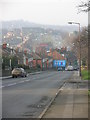
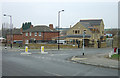
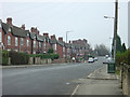
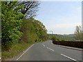
Area Overview for Thrybergh and Dalton
Photos of Thrybergh and Dalton
Area Information
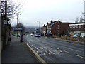
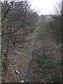
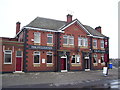
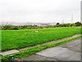
Living in Thrybergh and Dalton means residing in a compact built-up area of 1.7 km² in England, where daily life is shaped by its modest size and proximity to essential services. The area’s population is predominantly older, with a median age of 70, suggesting a community centred around established residents. Despite its small footprint, Thrybergh and Dalton offers practical access to a range of amenities, from retail outlets to public transport hubs. The broadband score of 99 ensures near-excellent internet connectivity, while mobile coverage at 84 is solid, supporting both remote work and everyday digital needs. For families, the area is served by five primary schools, including Thrybergh Junior School and Dalton Foljambe Primary School, providing multiple options for early education. While the population is older, the presence of diverse retail and transport links means residents can enjoy a balance of convenience and community. This area may appeal to those seeking a low-key, functional lifestyle with reliable infrastructure and minimal commute times to nearby towns.
- Area Type
- Built Up Area 250
- Area Size
- 1.7 km²
- Population
- Not available
- Population Density
- Not available
The lifestyle in Thrybergh and Dalton is shaped by its proximity to a variety of amenities within practical reach. Residents can access retail options such as Lidl Doncaster, Asda Rotherham, and Iceland Sycamore, ensuring daily shopping needs are met without long journeys. Public transport links, including metro stops like Parkgate and rail stations such as Rotherham Central, provide easy access to nearby towns and cities. The area’s five primary schools contribute to a family-friendly environment, though leisure and recreational facilities are not detailed in the data. The combination of retail, transport, and educational options suggests a practical, community-focused lifestyle, where residents can enjoy local conveniences while maintaining connections to broader regional networks.
Amenities
Schools
Residents of Thrybergh and Dalton have access to five primary schools, including Thrybergh Junior School, Thrybergh Infant School, and Dalton Foljambe Primary School. Additional options include Thrybergh Fullerton CofE VA Primary School and Trinity Croft CofE Junior and Infant School. These institutions cater to younger children, offering a range of educational settings, though no Ofsted ratings are provided in the data. The presence of multiple primary schools ensures families have several choices for their children’s early education, which may be particularly valuable in a community with a higher proportion of older residents. The concentration of primary schools also suggests the area is well-served for families requiring immediate access to schooling, though secondary education options are not detailed here.
| Rank | School | Type | Entry gender | Ages |
|---|
Explore more schools in this area
Go to Schools tabDemographics
The population of Thrybergh and Dalton is defined by its median age of 70, indicating a community where older residents form a significant proportion. Home ownership stands at 47%, suggesting that nearly half of properties are owner-occupied, while the remaining 53% are likely rented. The data does not specify household composition or ethnic diversity, but the accommodation types listed as “total” imply a mix of housing stock, possibly including both traditional and modern properties. The area’s age profile may influence local services, with amenities tailored to older adults. While no specific deprivation data is provided, the home ownership rate suggests a stable, long-term resident base. This demographic profile may appeal to buyers seeking a mature, settled community, though it also highlights the need for age-appropriate healthcare and social infrastructure.