Area Overview for Staveley (North Yorkshire)
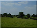
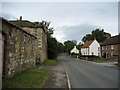
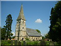
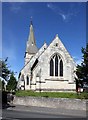
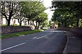
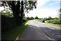
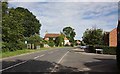
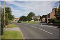
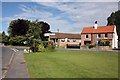
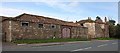
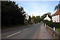
Photos of Staveley (North Yorkshire)

Area Information
Staveley in North Yorkshire is a compact built-up area spanning 22.4 hectares, offering a quiet, low-density living environment. With a median age of 70, the community is predominantly older, reflecting a demographic profile shaped by long-term residency and a strong sense of local continuity. The area’s modest size means it is not sprawling, with a focus on accessible, established housing. For residents, daily life is characterised by proximity to essential services, including three rail stations within practical reach—Knaresborough, Starbeck, and Harrogate—which connect to broader regional networks. The presence of Staveley Community Primary School, rated ‘good’ by Ofsted, ensures families have access to quality early education. While the area lacks large-scale amenities, its charm lies in its simplicity, with local shops and supermarkets like Morrisons and Asda within reach. Staveley’s appeal is rooted in its safety, with a crime risk score of 92, indicating a secure neighbourhood. This makes it a viable choice for those prioritising tranquillity and stability over urban vibrancy.
- Area Type
- Built Up Area 250
- Area Size
- 22.4 hectares
- Population
- Not available
- Population Density
- Not available
Staveley’s lifestyle is defined by its proximity to essential amenities within walking or short driving distance. Five retail outlets, including Morrisons Boroughbridge, Spar, and Asda Knaresborough, provide access to groceries and daily essentials. The three nearby rail stations—Knaresborough, Starbeck, and Harrogate—enhance mobility, enabling travel to larger centres for shopping, dining, or leisure. While the area lacks large parks or recreational spaces, its small footprint means residents are close to local services. The presence of RAF Dishforth nearby may offer unique opportunities for those connected to military or aviation sectors, though it is not a civilian amenity. Overall, Staveley’s lifestyle is practical, with a focus on simplicity and accessibility over expansive leisure options.
Amenities
Schools
Staveley’s primary educational offering is Staveley Community Primary School, which serves the area’s younger residents. Rated ‘good’ by Ofsted, the school provides a foundation for early education, though no secondary schools are listed in the data. This means families with older children may need to look beyond Staveley for secondary education options. The absence of additional schools suggests limited local provision for higher education, which could be a consideration for growing families. However, the presence of a well-rated primary school is a positive for those prioritising early learning. Parents should assess whether the local school meets their needs or if commuting to nearby towns like Knaresborough or Harrogate is necessary.
| Rank | School | Type | Entry gender | Ages |
|---|
Explore more schools in this area
Go to Schools tabDemographics
Staveley’s population is predominantly older, with a median age of 70, suggesting a community shaped by long-term settlement and limited recent growth. Home ownership is high, at 83%, indicating a stable, owner-occupied demographic. The data does not specify household composition or diversity, but the absence of detailed breakdowns implies a relatively homogenous population. The area’s accommodation types are not individually listed, though the high home ownership rate suggests a mix of private residences rather than rental properties. While no specific figures on deprivation are provided, the combination of high home ownership and low crime risk points to a community with relatively low socioeconomic pressure. However, the lack of detailed demographic data means broader conclusions about diversity or generational shifts remain unconfirmed.
Household Size
Accommodation Type
Tenure
Ethnic Group
Religion
Household Composition
Age
Household Deprivation
NS-SEC
Explore more demographic insights in this area
Go to Demographics tabPlanning
Planning Constraints
- Crime RiskPremium