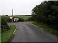
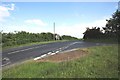
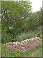
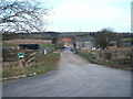
Area Overview for Staintondale
Photos of Staintondale


Area Information
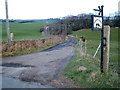
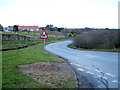
Living in Staintondale offers a quiet rural experience defined by its specific character as a civil parish in England. This small settlement spans an area of 13.4 km², providing a defined boundary for residents while maintaining a village atmosphere. You will find a location that prioritises tranquility over urban convenience, suitable for those seeking a slower pace of life. The parish structure suggests a recognisable community hub where local governance and social activities likely centre around designated village spaces. Daily life here revolves around the needs of a compact population, with services and amenities potentially centred within the parish boundaries or accessed via nearby towns. The sheer scale of the area, combined with its low population density, means you are far from the crowds found in larger towns. This makes Staintondale a distinct choice for anyone prioritising space and air. You can expect a consistent living environment where the landscape and community dynamics remain relatively stable. The parish designation indicates that Staintondale operates under its own local council, differentiating it from larger towns that may have broader urban governance. Your daily routine will likely involve travelling for specialist services, as the small footprint of 13.4 km² limits the range of large-scale commercial operations inside the parish itself. Yet, for those who value a rooted lifestyle, this self-contained nature offers a clear alternative to the unpredictability of city living.
- Area Type
- Parish
- Area Size
- 13.4 km²
- Population
- Not available
- Population Density
- Not available
Demographics
You will find a community in Staintondale with a strongly defined age profile, where the median age stands at exactly 70. This figure indicates a resident base that skews significantly towards older adults, creating a demographic focused on retirement living or established local tradition. The most common age range is the total population category, reflecting a neighbourhood where the majority of homes are occupied by over-65s rather than young families or students. Home ownership is a defining feature of this parish, with a staggering 79% of the housing stock owned outright or with a mortgage by the occupant. This high rate suggests a community where residents have deep roots and financial stability in the area. You are unlikely to encounter a contentious buy-to-let market; instead, you will see families or individuals who intend to stay for the long term. The predominant ethnic group and religious affiliations, while present in the community, are not the primary drivers of the area's current social fabric compared to age and ownership status. The household composition in Staintondale mirrors the age data, implying smaller family units or single-occupancy households. This contrasts with city centres where shared accommodation is common. Your neighbours are likely to be peers or older generation locals. The accommodation types reflect this, with properties designed for comfortable living rather than high-density blocks. The community feel is one of established permanence, where you move not just into a house, but into a long-term residence within a senior-focused neighbourhood.
Household Size
Accommodation Type
Tenure
Ethnic Group
Religion
Household Composition
Age
Household Deprivation
NS-SEC
Explore more demographic insights in this area
Go to Demographics tabPlanning
Planning Constraints
- Flood RiskPremium
- Ramsar Wetland SitesPremium
- Area of Outstanding Natural BeautyPremium
- Protected Nature ReservePremium
- Protected WoodlandPremium