Area Overview for South Kirkby
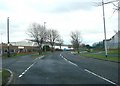
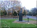
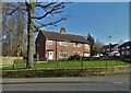
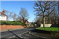
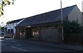
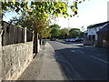
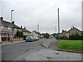
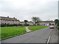
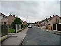
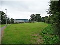
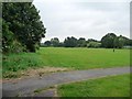
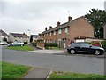
Photos of South Kirkby
Area Information
South Kirkby is a compact built-up area in England, covering 2.7 km² and home to a population with a median age of 70. This suggests a community skewed towards older residents, which shapes the character of daily life. The area is served by multiple primary schools, including Common Road First School and Burntwood First School, making it a practical choice for families. Nearby, retail options like Co-op South and Asda Moorthorpe provide essential services, while rail stations such as Moorthorpe Railway Station offer connectivity to surrounding towns. Despite its small size, South Kirkby balances accessibility with a sense of local identity. However, the high crime risk—rated critical with a safety score of 33—means residents should consider security measures. For those prioritising convenience and proximity to amenities, South Kirkby offers a mix of practicality and community, though its demographic profile and safety profile require careful consideration.
- Area Type
- Built Up Area 250
- Area Size
- 2.7 km²
- Population
- Not available
- Population Density
- Not available
Living in South Kirkby offers access to essential amenities within practical reach. Retail options include Co-op South, Morrisons Daily South, and Asda Moorthorpe, providing grocery and daily essentials. The rail network, with stations like Moorthorpe and Thurnscoe, connects residents to broader regional transport links. While the area lacks detailed data on parks or leisure facilities, the presence of multiple schools and shops suggests a community-oriented lifestyle. The convenience of nearby retail and transport options supports a practical, low-maintenance daily routine. However, without information on green spaces or recreational facilities, the full extent of lifestyle offerings remains unclear. For those prioritising accessibility over expansive amenities, South Kirkby provides a functional, community-focused environment.
Amenities
Schools
South Kirkby is served by several primary schools, including Common Road First School, Burntwood First School, and Stockingate First School, alongside Common Road Middle School and Northfield Middle School. While all are categorised as primary, the inclusion of "Middle School" in some names may reflect their role in providing education for older primary-age children. This variety offers families multiple options, though no Ofsted ratings are provided to assess their performance. The concentration of schools suggests a focus on local education, which can be a key factor for families. However, the absence of secondary schools in the data means parents may need to look beyond South Kirkby for secondary education. The proximity of these schools to homes enhances convenience but does not indicate academic quality without further information.
| Rank | A + A* % | School | Type | Entry gender | Ages |
|---|---|---|---|---|---|
| 1 | N/A | Common Road First School | primary | N/A | N/A |
| 2 | N/A | Burntwood First School | primary | N/A | N/A |
| 3 | N/A | Stockingate First School | primary | N/A | N/A |
| 4 | N/A | Common Road Middle School | primary | N/A | N/A |
| 5 | N/A | Northfield Middle School | primary | N/A | N/A |
Explore more schools in this area
Go to Schools tabDemographics
South Kirkby’s population has a median age of 70, with the most common age range encompassing all age groups. This indicates a community where older residents form a significant proportion. Home ownership stands at 56%, suggesting a mix of owner-occupied and rental properties. The data does not specify household composition or accommodation types, but the overall figure implies a stable, long-term resident base. The area’s demographic profile may influence local services and amenities, with schools and retail tailored to a mature population. While no specific diversity metrics are provided, the lack of detailed breakdowns means assumptions about cultural or ethnic composition cannot be made. For quality of life, the high home ownership rate could signal a settled community, though the absence of deprivation data means its impact on daily living remains unquantified.
Household Size
Accommodation Type
Tenure
Ethnic Group
Religion
Household Composition
Age
Household Deprivation
NS-SEC
Explore more demographic insights in this area
Go to Demographics tabPlanning
Planning Constraints
- Crime RiskLocked