Area Overview for Shiregreen & Brightside Ward
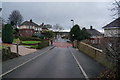
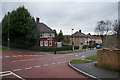
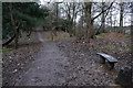
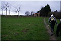
Photos of Shiregreen & Brightside Ward
Area Information
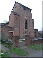
Shiregreen & Brightside Ward is an electoral ward in the City of Sheffield, situated within the Yorkshire and the Humber region. It covers an area of 6.5 square kilometres with a population of 4,356 residents. This ward encompasses the locality of Brightside, which sits north of the River Don. The area forms part of the original Brightside Bierlow division of Sheffield township. Historically, the location was first recorded in the 15th century under names such as Brekesherth. It developed around water-powered mills and later expanded into steel and cutlery manufacture following the opening of the Sheffield and Rotherham Railway in the 1830s. Today, the ward includes land extending towards the Wicker and Neepsend. One of its notable landmarks is St Thomas Church, which opened in 1854 and currently functions as a training school for Greentop Circus. Living in Shiregreen & Brightside Ward involves navigating a landscape shaped by its industrial heritage while enjoying excellent digital connectivity. The ward operates as part of the Sheffield Brightside and Hillsborough parliamentary constituency, reflecting its historical significance as a parliamentary constituency before a merger occurred due to population changes.
- Area Type
- District Borough Unitary Ward
- Area Size
- 6.5 km²
- Population
- 4356
- Population Density
- 668 people/km²
Demographics
The community composition in Shiregreen & Brightside Ward reflects a mature population profile. Approximately two-thirds of residents are 65 years of age or older, making this one of the older wards in Sheffield. The median age across the ward is 70 years. Home ownership is established within the area, with 51% of households owning their property outright or through a mortgage. The remaining 49% of households rent their accommodation. Specific figures indicate that 4,356 people call this 6.5 square kilometre area home. The ward contains a mix of household types typical of a residential district in South Yorkshire. There are no specific data points provided regarding the predominant ethnic group or religious affiliation within this specific ward. The high proportion of older residents suggests a community where many people have lived in their homes for decades. This demographic profile influences local service needs and the social fabric of the neighbourhood.
Household Size
Accommodation Type
Tenure
Ethnic Group
Religion
Household Composition
Age
Household Deprivation
NS-SEC
Explore more demographic insights in this area
Go to Demographics tabPlanning
Planning Constraints
- Flood RiskPremium
- Ramsar Wetland SitesPremium
- Area of Outstanding Natural BeautyPremium
- Protected Nature ReservePremium
- Protected WoodlandPremium
- Crime RiskPremium