Area Overview for S9 5GL
Photos of S9 5GL
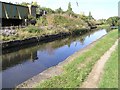
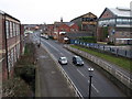
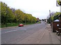

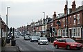
91 photos from this area
Area Information
Key information about the S9 5GL including its size, population, and administrative classification.
- Area Type
- Postcode
- Area Size
- 1.0 hectares
- Population
- 1711
- Population Density
- 926 people/km²
House Prices in S9 5GL
51
Properties
£86,167
Average Sold Price
£57,000
Lowest Price
£110,000
Highest Price
Showing 51 properties
| Address | Type | Beds | Baths | Last Sale Price | Last Sale Date | |
|---|---|---|---|---|---|---|
| 48 Coleridge Gardens, Sheffield, S9 5GL | house | - | - | £110,000 | Feb 2024 | |
| 46 Coleridge Gardens, Sheffield, S9 5GL | house | - | - | £100,000 | Jan 2022 | |
| 40 Coleridge Gardens, Sheffield, S9 5GL | house | 3 | - | £96,000 | Mar 2021 | |
| 19 Coleridge Gardens, Sheffield, S9 5GL | Semi-detached | - | - | £75,000 | Oct 2015 | |
| 21 Coleridge Gardens, Sheffield, S9 5GL | Terraced | 3 | - | £57,000 | Feb 2014 | |
| 39 Coleridge Gardens, Sheffield, S9 5GL | house | - | - | £79,000 | Feb 2006 | |
| 51 Coleridge Gardens, Sheffield, S9 5GL | house | 2 | - | - | - | |
| 1 Coleridge Gardens, Sheffield, S9 5GL | Terraced | - | - | - | - | |
| 12 Coleridge Gardens, Sheffield, S9 5GL | house | - | - | - | - | |
| 34 Coleridge Gardens, Sheffield, S9 5GL | Flat | - | - | - | - |
Page 1 of 6
Energy Efficiency in S9 5GL
Amenities
Schools
| Rank | School | Type | Entry gender | Ages |
|---|
Explore more schools in this area
Go to Schools tabDemographics
Household Size
Family (3-5 people)
most common
Accommodation Type
Houses
most common
Tenure
29
majority
Ethnic Group
asian_total
most common
Religion
N/A
most common
Household Composition
N/A
most common
Age
47
median
Adults (30-64 years)
most common
Household Deprivation
N/A
with no deprivation
NS-SEC
9
in Lower managerial occupations
Explore more demographic insights in this area
Go to Demographics tabPlanning
Planning Constraints
- Flood RiskPremium
- Ramsar Wetland SitesPremium
- Area of Outstanding Natural BeautyPremium
- Protected Nature ReservePremium
- Protected WoodlandPremium