Area Overview for S9 4LN
Photos of S9 4LN
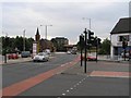
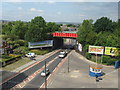
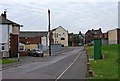
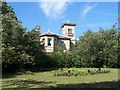
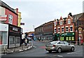
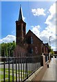
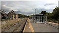
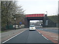
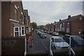
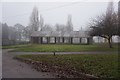
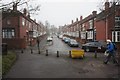
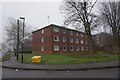
61 photos from this area
Area Information
Key information about the S9 4LN including its size, population, and administrative classification.
- Area Type
- Postcode
- Area Size
- 3587 m²
- Population
- 2862
- Population Density
- 10299 people/km²
House Prices in S9 4LN
19
Properties
£52,600
Average Sold Price
£14,000
Lowest Price
£90,000
Highest Price
Showing 19 properties
| Address | Type | Beds | Baths | Last Sale Price | Last Sale Date | |
|---|---|---|---|---|---|---|
| 588 Staniforth Road, Sheffield, S9 4LN | house | - | - | £75,000 | Apr 2024 | |
| 610 STANIFORTH ROAD, Sheffield, S9 4LN | Detached | - | - | £90,000 | Aug 2022 | |
| 604A Staniforth Road, Sheffield, S9 4LN | Flat | - | - | £56,000 | Dec 2005 | |
| 602A Staniforth Road, Sheffield, S9 4LN | Flat | - | - | £14,000 | Nov 1998 | |
| 586 Staniforth Road, Sheffield, S9 4LN | house | - | - | £28,000 | Mar 1998 | |
| 626A Staniforth Road, Sheffield, S9 4LN | Terraced | - | 1 | - | - | |
| Flat Over, 620 Staniforth Road, Sheffield, S9 4LN | Flat | - | - | - | - | |
| Flat Over, 598 Staniforth Road, Sheffield, S9 4LN | Flat | - | - | - | - | |
| Flat Over 592, Staniforth Road, Sheffield, S9 4LN | Flat | - | - | - | - | |
| 616A Staniforth Road, Sheffield, S9 4LN | Flat | - | - | - | - |
Page 1 of 2
Energy Efficiency in S9 4LN
Amenities
Schools
| Rank | School | Type | Entry gender | Ages |
|---|
Explore more schools in this area
Go to Schools tabDemographics
Household Size
Family (3-5 people)
most common
Accommodation Type
Houses
most common
Tenure
51
majority
Ethnic Group
asian_total
most common
Religion
N/A
most common
Household Composition
N/A
most common
Age
22
median
Adults (30-64 years)
most common
Household Deprivation
N/A
with no deprivation
NS-SEC
13
in Lower managerial occupations
Explore more demographic insights in this area
Go to Demographics tabPlanning
Planning Constraints
- Flood RiskPremium
- Ramsar Wetland SitesPremium
- Area of Outstanding Natural BeautyPremium
- Protected Nature ReservePremium
- Protected WoodlandPremium