Area Overview for S9 1AG
Photos of S9 1AG
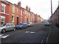
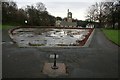
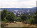
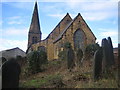
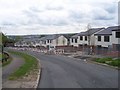
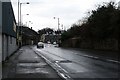
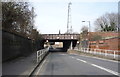
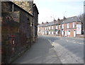
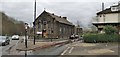
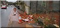
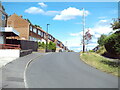
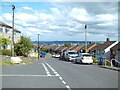
40 photos from this area
Area Information
Key information about the S9 1AG including its size, population, and administrative classification.
- Area Type
- Postcode
- Area Size
- 1.0 hectares
- Population
- 1750
- Population Density
- 4436 people/km²
House Prices in S9 1AG
31
Properties
£78,088
Average Sold Price
£840
Lowest Price
£150,000
Highest Price
Showing 31 properties
| Address | Type | Beds | Baths | Last Sale Price | Last Sale Date | |
|---|---|---|---|---|---|---|
| 90 Sandstone Road, Sheffield, S9 1AG | Semi-detached | 3 | 1 | £149,000 | Aug 2024 | |
| 88 Sandstone Road, Sheffield, S9 1AG | Semi-detached | 3 | 1 | £150,000 | May 2024 | |
| 42A Sandstone Road, Sheffield, S9 1AG | Flat | - | - | £50,000 | Sep 2023 | |
| 102 Sandstone Road, Sheffield, S9 1AG | Semi-detached | - | - | £840 | Feb 2020 | |
| 96 Sandstone Road, Sheffield, S9 1AG | Semi-detached | 3 | - | £108,000 | Aug 2019 | |
| 100 Sandstone Road, Sheffield, S9 1AG | Semi-detached | 3 | 1 | £115,000 | Feb 2017 | |
| 80 Sandstone Road, Sheffield, S9 1AG | Semi-detached | 3 | 1 | £83,000 | Apr 2014 | |
| 44A Sandstone Road, Sheffield, S9 1AG | Flat | - | - | £90,000 | Jun 2011 | |
| 84 Sandstone Road, Sheffield, S9 1AG | Semi-detached | 3 | 1 | £95,000 | Nov 2009 | |
| 92 Sandstone Road, Sheffield, S9 1AG | Semi-detached | 3 | 1 | £96,000 | Aug 2004 |
Page 1 of 4
Energy Efficiency in S9 1AG
Amenities
Schools
| Rank | School | Type | Entry gender | Ages |
|---|
Explore more schools in this area
Go to Schools tabDemographics
Household Size
Two person
most common
Accommodation Type
Houses
most common
Tenure
74
majority
Ethnic Group
White
most common
Religion
N/A
most common
Household Composition
N/A
most common
Age
47
median
Adults (30-64 years)
most common
Household Deprivation
N/A
with no deprivation
NS-SEC
26
in Lower managerial occupations
Explore more demographic insights in this area
Go to Demographics tabPlanning
Planning Constraints
- Flood RiskPremium
- Ramsar Wetland SitesPremium
- Area of Outstanding Natural BeautyPremium
- Protected Nature ReservePremium
- Protected WoodlandPremium