Area Overview for S8 0XQ
Photos of S8 0XQ
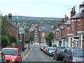
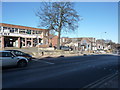
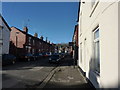
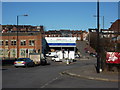
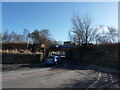
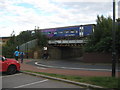
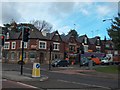


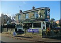
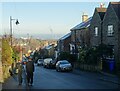
99 photos from this area
Area Information
Key information about the S8 0XQ including its size, population, and administrative classification.
- Area Type
- Postcode
- Area Size
- 2.9 hectares
- Population
- 1749
- Population Density
- 7986 people/km²
House Prices in S8 0XQ
20
Properties
£144,250
Average Sold Price
£77,000
Lowest Price
£180,000
Highest Price
Showing 20 properties
| Address | Type | Beds | Baths | Last Sale Price | Last Sale Date | |
|---|---|---|---|---|---|---|
| 316 Broadfield Road, Sheffield, S8 0XQ | Terraced | 3 | 1 | £145,000 | Apr 2024 | |
| 310 Broadfield Road, Sheffield, S8 0XQ | house | - | - | £175,000 | Mar 2024 | |
| 314 Broadfield Road, Sheffield, S8 0XQ | Terraced | 3 | 1 | £180,000 | Mar 2023 | |
| 312 Broadfield Road, Sheffield, S8 0XQ | Terraced | - | - | £77,000 | Sep 2006 | |
| Aca Windows, Unit 7A, The Old Dairy, Broadfield Road, Sheffield, S8 0XQ | Industrial | - | - | - | - | |
| Abbeydale, Unit 8B, The Old Dairy, Broadfield Road, Sheffield, S8 0XQ | Industrial | - | - | - | - | |
| Buffalo Systems Ltd, Unit 2B, The Old Dairy, Broadfield Road, Sheffield, S8 0XQ | office_workshop | - | - | - | - | |
| Unit 7, The Old Dairy, Broadfield Road, Sheffield, S8 0XQ | Office | - | - | - | - | |
| Three Source Ltd, Unit 4, The Old Dairy, Broadfield Road, Sheffield, S8 0XQ | warehouse | - | - | - | - | |
| W Minton Ltd, Warehouse, The Old Dairy, Broadfield Road, Sheffield, S8 0XQ | warehouse | - | - | - | - |
Page 1 of 2
Energy Efficiency in S8 0XQ
Amenities
Schools
| Rank | School | Type | Entry gender | Ages |
|---|
Explore more schools in this area
Go to Schools tabDemographics
Household Size
Family (3-5 people)
most common
Accommodation Type
Houses
most common
Tenure
42
majority
Ethnic Group
asian_total
most common
Religion
N/A
most common
Household Composition
N/A
most common
Age
47
median
Adults (30-64 years)
most common
Household Deprivation
N/A
with no deprivation
NS-SEC
19
in Lower managerial occupations
Explore more demographic insights in this area
Go to Demographics tabPlanning
Planning Constraints
- Flood RiskPremium
- Ramsar Wetland SitesPremium
- Area of Outstanding Natural BeautyPremium
- Protected Nature ReservePremium
- Protected WoodlandPremium