Area Overview for S8 0RP
Photos of S8 0RP
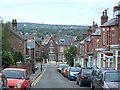
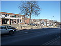
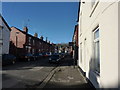
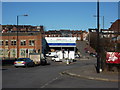
99 photos from this area
Area Information
Key information about the S8 0RP including its size, population, and administrative classification.
- Area Type
- Postcode
- Area Size
- 6387 m²
- Population
- 1482
- Population Density
- 3044 people/km²
House Prices in S8 0RP
37
Properties
£167,474
Average Sold Price
£33,000
Lowest Price
£373,000
Highest Price
Showing 37 properties
| Address | Type | Beds | Baths | Last Sale Price | Last Sale Date | |
|---|---|---|---|---|---|---|
| 231 Chesterfield Road, Sheffield, S8 0RP | Terraced | 4 | 2 | £325,000 | Aug 2024 | |
| 187 Chesterfield Road, Sheffield, S8 0RP | Terraced | 3 | 1 | £240,000 | Sep 2023 | |
| 225 Chesterfield Road, Sheffield, S8 0RP | house | - | - | £317,500 | May 2023 | |
| 233 Chesterfield Road, Sheffield, S8 0RP | house | 5 | 2 | £285,000 | Oct 2022 | |
| 207 Chesterfield Road, Sheffield, S8 0RP | house | 3 | 2 | £373,000 | Jun 2022 | |
| 181 Chesterfield Road, Sheffield, S8 0RP | Detached | 3 | 1 | £95,000 | Mar 2020 | |
| 177 Chesterfield Road, Sheffield, S8 0RP | Terraced | 3 | 1 | £130,000 | Oct 2019 | |
| 179 Chesterfield Road, Sheffield, S8 0RP | house | - | - | £145,000 | Dec 2018 | |
| 237 Chesterfield Road, Sheffield, S8 0RP | Terraced | 2 | 1 | £155,000 | Jun 2017 | |
| 219 Chesterfield Road, Sheffield, S8 0RP | house | - | - | £240,000 | Jan 2017 |
Page 1 of 4
Energy Efficiency in S8 0RP
Amenities
Schools
| Rank | School | Type | Entry gender | Ages |
|---|
Explore more schools in this area
Go to Schools tabDemographics
Household Size
Family (3-5 people)
most common
Accommodation Type
Houses
most common
Tenure
70
majority
Ethnic Group
White
most common
Religion
N/A
most common
Household Composition
N/A
most common
Age
47
median
Adults (30-64 years)
most common
Household Deprivation
N/A
with no deprivation
NS-SEC
45
in Lower managerial occupations
Explore more demographic insights in this area
Go to Demographics tabPlanning
Planning Constraints
- Flood RiskPremium
- Ramsar Wetland SitesPremium
- Area of Outstanding Natural BeautyPremium
- Protected Nature ReservePremium
- Protected WoodlandPremium