Area Overview for S75 4NG
Photos of S75 4NG


Area Information
Living in S75 4NG means residing within a specific residential cluster covering 31.5 hectares in England. This locality houses a population of 1,390 people within a relatively compact footprint. The average density stands at 455 people per square kilometre, creating a neighbourhood that feels intimate yet distinct from larger urban centres. The postcode is defined by its exclusivity as a small residential grouping rather than a sprawling town. Residents here experience daily life without the congestion of major metropolitan hubs. You will find yourself in an area where the built environment is tightly controlled by its postal boundaries. This concentration of homes creates a strong sense of local identity among those who call this postcode home. The area sits quietly away from the busiest corridors, offering a structured environment for families and individuals seeking a defined place to live. You are looking at a community where the character of the neighbourhood is easily understood by anyone who enters the gates defined by this postcode. The compact nature of S75 4NG ensures that distances are manageable and the local character remains consistent for all inhabitants.
- Area Type
- Postcode
- Area Size
- 31.5 hectares
- Population
- 1390
- Population Density
- 455 people/km²
The property market in S75 4NG is overwhelmingly dominated by owner-occupied homes. An impressive 81% of residents are homeowners, indicating a stable market where sales and long-term occupancy prevail. Houses are the sole accommodation type identified for this specific postcode, meaning you will not find purpose-built flats or apartment blocks in this cluster. This housing stock reflects a desire for traditional ownership rather than rental living. Buyers looking at homes in S75 4NG are entering a market defined by permanence and self-management. The high rate of home ownership suggests thatPropertyValue retains significant value for those who hold their titles. Rental properties are rare within these boundaries. If you are considering buying property near S75 4NG, you are likely entering a competitive market where families and retirees are already established. The landscape is purely residential with no mixed-use developments altering the character of the streets. You will find that the local market prioritizes freehold homes over leasehold arrangements or private rentals.
House Prices in S75 4NG
Showing 11 properties
| Address | Type | Beds | Baths | Last Sale Price | Last Sale Date | |
|---|---|---|---|---|---|---|
| White Lodge, Barnsley Road, Silkstone, Barnsley, S75 4NG | house | 4 | 3 | £650,000 | Jun 2022 | |
| Noblethorpe Hall, Barnsley Road, Silkstone, Barnsley, S75 4NG | Detached | 5 | 3 | £1,560,000 | Mar 2022 | |
| Meadowview Barn, Barnsley Road, Silkstone, Barnsley, S75 4NG | Semi-detached | 5 | 3 | £750,000 | Feb 2021 | |
| Yew Tree Cottage, Barnsley Road, Silkstone, Barnsley, S75 4NG | Semi-detached | 4 | 2 | £225,000 | May 2019 | |
| Noblethorpe Lodge, Barnsley Road, Silkstone, Barnsley, S75 4NG | house | - | - | £325,000 | Dec 2017 | |
| The Coach House, Barnsley Road, Silkstone, Barnsley, S75 4NG | house | - | - | £455,000 | Nov 2010 | |
| Gardeners Cottage, Barnsley Road, Silkstone, Barnsley, S75 4NG | Detached | 5 | 3 | - | - | |
| The Mews Cottage, Barnsley Road, Silkstone, Barnsley, S75 4NG | Terraced | - | - | - | - | |
| The Clock Tower, Barnsley Road, Silkstone, Barnsley, S75 4NG | Terraced | - | - | - | - | |
| The Granary, Barnsley Road, Silkstone, Barnsley, S75 4NG | Detached | - | - | - | - |
Energy Efficiency in S75 4NG
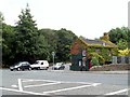
Daily life in S75 4NG is supported by a ring of essential amenities within practical reach. Retail options include Asda Silkestone, Co-op Dodworth, and Co-op Penistone, providing supermarkets and daily essentials without requiring a long trek to a shopping centre. You can handle weekly grocery shopping and household necessities through these three specific venues. For rail accessibility, there are five stations nearby including Silkstone Common, Dodworth, and Penistone Railway Station. These five stations offer you multiple train connections to wider destinations without needing to drive. The presence of Asda Silkestone and the three railway stations creates a convenient hub for food and commuting. Residents do not need to venture far to restock groceries or catch a train to the city. The proximity of these five key facilities ensures that the basic needs of life are met with minimal effort. Nearby amenities like the Co‑ops and the railway stations define the convenience of living in this S75 4NG postcode. You have supermarkets and rail links at your doorstep, supporting a self-sufficient lifestyle.
Amenities
Schools
Families considering this area have access to specific educational institutions within practical reach. Silkstone Primary School serves as a local primary education provider and holds a 'good' Ofsted rating. This school offers a standard of education verified by official inspectors. For those seeking private education options, Silverwood School operates as an independent school nearby. The presence of both state-funded primary education and independent schooling provides a range of choices for parents. You do not need to travel far to secure education for your children within or near this postcode. The combination of a primary school with a good rating and an independent institution suggests a community that values education highly. Schools near S75 4NG are well represented for their location size. The availability of these two distinct options means you can choose between comprehensive state education with a good rating or an independent curriculum. Both schools are located close enough to be considered daily options for residents of the postcode.
| Rank | School | Type | Entry gender | Ages |
|---|
Explore more schools in this area
Go to Schools tabDemographics
The community profile of S75 4NG is shaped by a mature demographic with a median age of 47. Adults between 30 and 64 years old form the most common age range within this postcode. This age distribution indicates a settled population rather than a transient one. Home ownership is the dominant financial arrangement, with 81% of residents occupying their own property. This high percentage of owner-occupiers builds a stable community where long-term investment is common. Houses represent the primary type of accommodation found throughout the area. There are no significant discussions of flats or apartments within the housing stock of this specific postcode. The demographic profile reflects a predominantly White population, which is the most common ethnic group recorded here. These facts suggest a neighbourhood where residents have put down roots and prioritize ownership over renting. The community is characterised by established households rather than young professionals or students moving in temporary accommodation. Every statistic confirms a stable, owner-led community structure typical of established residential clusters in postcodes like S75 4NG.
Household Size
Accommodation Type
Tenure
Ethnic Group
Religion
Household Composition
Age
Household Deprivation
NS-SEC
Explore more demographic insights in this area
Go to Demographics tabPlanning
Planning Constraints
- Flood RiskPremium
- Ramsar Wetland SitesPremium
- Area of Outstanding Natural BeautyPremium
- Protected Nature ReservePremium
- Protected WoodlandPremium