Area Overview for S75 3NW
Photos of S75 3NW
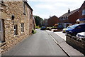
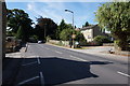
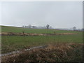
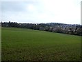
45 photos from this area
Area Information
Key information about the S75 3NW including its size, population, and administrative classification.
- Area Type
- Postcode
- Area Size
- 5.9 hectares
- Population
- 1677
- Population Density
- 537 people/km²
House Prices in S75 3NW
42
Properties
£85,892
Average Sold Price
£24,950
Lowest Price
£155,000
Highest Price
Showing 42 properties
| Address | Type | Beds | Baths | Last Sale Price | Last Sale Date | |
|---|---|---|---|---|---|---|
| 89 Intake Crescent, Dodworth, Barnsley, S75 3NW | Semi-detached | 3 | 1 | £155,000 | May 2024 | |
| 20 Intake Crescent, Dodworth, Barnsley, S75 3NW | Semi-detached | 3 | 1 | £115,000 | Dec 2023 | |
| 101 Intake Crescent, Dodworth, Barnsley, S75 3NW | house | 3 | - | £135,000 | Nov 2020 | |
| 34 Intake Crescent, Dodworth, Barnsley, S75 3NW | Semi-detached | 3 | 1 | £102,800 | Oct 2019 | |
| 97 Intake Crescent, Dodworth, Barnsley, S75 3NW | Semi-detached | 3 | - | £120,000 | Feb 2017 | |
| 6 Intake Crescent, Dodworth, Barnsley, S75 3NW | house | - | - | £75,000 | Dec 2012 | |
| 52 Intake Crescent, Dodworth, Barnsley, S75 3NW | Semi-detached | - | - | £116,000 | May 2007 | |
| 2 Intake Crescent, Dodworth, Barnsley, S75 3NW | Semi-detached | 2 | - | £92,500 | Apr 2006 | |
| 60 Intake Crescent, Dodworth, Barnsley, S75 3NW | Semi-detached | - | - | £70,000 | Jun 2003 | |
| 107 Intake Crescent, Dodworth, Barnsley, S75 3NW | house | 3 | - | £35,000 | Jul 2002 |
Page 1 of 5
Energy Efficiency in S75 3NW
Amenities
Schools
| Rank | School | Type | Entry gender | Ages |
|---|
Explore more schools in this area
Go to Schools tabDemographics
Household Size
Two person
most common
Accommodation Type
Houses
most common
Tenure
84
majority
Ethnic Group
White
most common
Religion
N/A
most common
Household Composition
N/A
most common
Age
47
median
Adults (30-64 years)
most common
Household Deprivation
N/A
with no deprivation
NS-SEC
40
in Lower managerial occupations
Explore more demographic insights in this area
Go to Demographics tabPlanning
Planning Constraints
- Flood RiskPremium
- Ramsar Wetland SitesPremium
- Area of Outstanding Natural BeautyPremium
- Protected Nature ReservePremium
- Protected WoodlandPremium