Area Overview for S75 2RS
Photos of S75 2RS

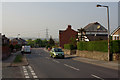
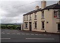
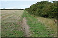
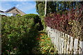
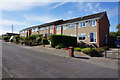
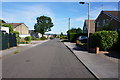
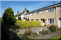
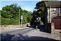
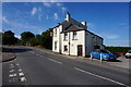
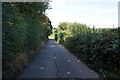
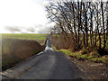
23 photos from this area
Area Information
Key information about the S75 2RS including its size, population, and administrative classification.
- Area Type
- Postcode
- Area Size
- 24.0 hectares
- Population
- 1449
- Population Density
- 451 people/km²
House Prices in S75 2RS
37
Properties
£194,262
Average Sold Price
£34,000
Lowest Price
£752,000
Highest Price
Showing 37 properties
| Address | Type | Beds | Baths | Last Sale Price | Last Sale Date | |
|---|---|---|---|---|---|---|
| 48 Redbrook Road, Gawber, Barnsley, S75 2RS | Detached | 3 | 1 | £100,000 | Aug 2025 | |
| 54 Redbrook Road, Gawber, Barnsley, S75 2RS | Semi-detached | 3 | 1 | £235,000 | Jul 2024 | |
| 42 Redbrook Road, Gawber, Barnsley, S75 2RS | house | - | - | £172,500 | Jun 2024 | |
| Mill House, Redbrook Road, Gawber, Barnsley, S75 2RS | Detached | 7 | 5 | £752,000 | Mar 2024 | |
| 22 Redbrook Road, Gawber, Barnsley, S75 2RS | house | - | - | £118,000 | Apr 2022 | |
| 38 Redbrook Road, Gawber, Barnsley, S75 2RS | house | 3 | 1 | £207,000 | Mar 2022 | |
| 36 Redbrook Road, Gawber, Barnsley, S75 2RS | house | - | - | £140,000 | Jun 2021 | |
| Oak House, Redbrook Road, Gawber, Barnsley, S75 2RS | Detached | - | - | £300,000 | Jan 2020 | |
| 50 Redbrook Road, Gawber, Barnsley, S75 2RS | Semi-detached | 3 | 1 | £168,000 | Jan 2020 | |
| 24 Redbrook Road, Gawber, Barnsley, S75 2RS | house | - | - | £320,000 | Nov 2019 |
Page 1 of 4
Energy Efficiency in S75 2RS
Amenities
Schools
| Rank | School | Type | Entry gender | Ages |
|---|
Explore more schools in this area
Go to Schools tabDemographics
Household Size
Two person
most common
Accommodation Type
Houses
most common
Tenure
83
majority
Ethnic Group
White
most common
Religion
N/A
most common
Household Composition
N/A
most common
Age
47
median
Adults (30-64 years)
most common
Household Deprivation
N/A
with no deprivation
NS-SEC
33
in Lower managerial occupations
Explore more demographic insights in this area
Go to Demographics tabPlanning
Planning Constraints
- Flood RiskPremium
- Ramsar Wetland SitesPremium
- Area of Outstanding Natural BeautyPremium
- Protected Nature ReservePremium
- Protected WoodlandPremium