Area Overview for S74 0PW
Photos of S74 0PW


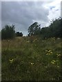
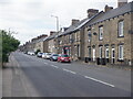
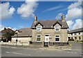


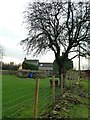
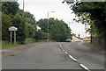
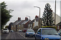
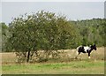
24 photos from this area
Area Information
Key information about the S74 0PW including its size, population, and administrative classification.
- Area Type
- Postcode
- Area Size
- 6086 m²
- Population
- 1536
- Population Density
- 1162 people/km²
House Prices in S74 0PW
25
Properties
£76,281
Average Sold Price
£21,500
Lowest Price
£160,000
Highest Price
Showing 25 properties
| Address | Type | Beds | Baths | Last Sale Price | Last Sale Date | |
|---|---|---|---|---|---|---|
| 88 Tinker Lane, Hoyland Common, Barnsley, S74 0PW | Terraced | 2 | 1 | £160,000 | Nov 2025 | |
| 98 Tinker Lane, Hoyland Common, Barnsley, S74 0PW | Terraced | 2 | 1 | £125,000 | May 2023 | |
| 90 Tinker Lane, Hoyland Common, Barnsley, S74 0PW | Terraced | 3 | 1 | £99,950 | Mar 2021 | |
| 100 Tinker Lane, Hoyland Common, Barnsley, S74 0PW | Semi-detached | 2 | - | £89,950 | Dec 2017 | |
| 84 Tinker Lane, Hoyland Common, Barnsley, S74 0PW | house | - | - | £95,000 | Sep 2007 | |
| 72 Tinker Lane, Hoyland Common, Barnsley, S74 0PW | Terraced | - | - | £146,000 | Jul 2007 | |
| 78 Tinker Lane, Hoyland Common, Barnsley, S74 0PW | Terraced | - | - | £97,500 | Dec 2005 | |
| 76 Tinker Lane, Hoyland Common, Barnsley, S74 0PW | Terraced | - | - | £35,250 | Jul 2002 | |
| 82 Tinker Lane, Hoyland Common, Barnsley, S74 0PW | Terraced | - | - | £34,000 | Oct 2000 | |
| 74 Tinker Lane, Hoyland Common, Barnsley, S74 0PW | Terraced | - | - | £36,000 | Aug 2000 |
Page 1 of 3
Energy Efficiency in S74 0PW
Amenities
Schools
| Rank | School | Type | Entry gender | Ages |
|---|
Explore more schools in this area
Go to Schools tabDemographics
Household Size
Two person
most common
Accommodation Type
Houses
most common
Tenure
56
majority
Ethnic Group
White
most common
Religion
N/A
most common
Household Composition
N/A
most common
Age
47
median
Adults (30-64 years)
most common
Household Deprivation
N/A
with no deprivation
NS-SEC
23
in Lower managerial occupations
Explore more demographic insights in this area
Go to Demographics tabPlanning
Planning Constraints
- Flood RiskPremium
- Ramsar Wetland SitesPremium
- Area of Outstanding Natural BeautyPremium
- Protected Nature ReservePremium
- Protected WoodlandPremium