Area Overview for S74 0EP
Photos of S74 0EP
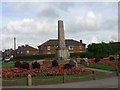
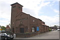


37 photos from this area
Area Information
Key information about the S74 0EP including its size, population, and administrative classification.
- Area Type
- Postcode
- Area Size
- 1.5 hectares
- Population
- 1476
- Population Density
- 1378 people/km²
House Prices in S74 0EP
54
Properties
£128,538
Average Sold Price
£25,520
Lowest Price
£208,000
Highest Price
Showing 54 properties
| Address | Type | Beds | Baths | Last Sale Price | Last Sale Date | |
|---|---|---|---|---|---|---|
| 111 Springwood Road, Hoyland, Barnsley, S74 0EP | house | - | - | £140,000 | Nov 2023 | |
| 48 Springwood Road, Hoyland, Barnsley, S74 0EP | Retail | 3 | 1 | £147,000 | Dec 2022 | |
| 70 Springwood Road, Hoyland, Barnsley, S74 0EP | Semi-detached | 4 | 2 | £208,000 | Nov 2022 | |
| 54 Springwood Road, Hoyland, Barnsley, S74 0EP | house | - | - | £168,500 | Jun 2022 | |
| 50 Springwood Road, Hoyland, Barnsley, S74 0EP | Semi-detached | 3 | 1 | £170,000 | Sep 2021 | |
| 87 Springwood Road, Hoyland, Barnsley, S74 0EP | house | - | - | £120,000 | Jun 2021 | |
| 60 Springwood Road, Hoyland, Barnsley, S74 0EP | house | - | - | £120,000 | Jun 2019 | |
| 66 Springwood Road, Hoyland, Barnsley, S74 0EP | Semi-detached | 3 | 1 | £119,950 | Mar 2018 | |
| 117 Springwood Road, Hoyland, Barnsley, S74 0EP | house | - | - | £115,000 | Nov 2015 | |
| 76 Springwood Road, Hoyland, Barnsley, S74 0EP | Semi-detached | - | - | £79,950 | Oct 2007 |
Page 1 of 6
Energy Efficiency in S74 0EP
Amenities
Schools
| Rank | School | Type | Entry gender | Ages |
|---|
Explore more schools in this area
Go to Schools tabDemographics
Household Size
Two person
most common
Accommodation Type
Houses
most common
Tenure
77
majority
Ethnic Group
White
most common
Religion
N/A
most common
Household Composition
N/A
most common
Age
47
median
Adults (30-64 years)
most common
Household Deprivation
N/A
with no deprivation
NS-SEC
26
in Lower managerial occupations
Explore more demographic insights in this area
Go to Demographics tabPlanning
Planning Constraints
- Flood RiskPremium
- Ramsar Wetland SitesPremium
- Area of Outstanding Natural BeautyPremium
- Protected Nature ReservePremium
- Protected WoodlandPremium