Area Overview for S73 9RG
Photos of S73 9RG
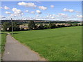
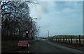
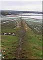
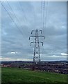
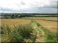

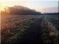
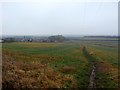
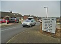
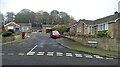
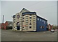
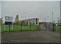
52 photos from this area
Area Information
Key information about the S73 9RG including its size, population, and administrative classification.
- Area Type
- Postcode
- Area Size
- 2.1 hectares
- Population
- 1109
- Population Density
- 224 people/km²
House Prices in S73 9RG
26
Properties
£185,888
Average Sold Price
£60,000
Lowest Price
£365,000
Highest Price
Showing 26 properties
| Address | Type | Beds | Baths | Last Sale Price | Last Sale Date | |
|---|---|---|---|---|---|---|
| 29 Lugano Grove, Darfield, Barnsley, S73 9RG | Bungalow | 3 | 1 | £365,000 | Mar 2025 | |
| 13 Lugano Grove, Darfield, Barnsley, S73 9RG | Bungalow | 2 | 1 | £252,500 | Jan 2024 | |
| 27 Lugano Grove, Darfield, Barnsley, S73 9RG | Bungalow | 3 | 2 | £283,000 | Nov 2020 | |
| 10 Lugano Grove, Darfield, Barnsley, S73 9RG | Bungalow | - | - | £147,000 | Nov 2019 | |
| 21 Lugano Grove, Darfield, Barnsley, S73 9RG | Bungalow | - | - | £219,950 | Oct 2018 | |
| 23 Lugano Grove, Darfield, Barnsley, S73 9RG | Bungalow | 3 | 1 | £193,000 | Aug 2018 | |
| 3 Lugano Grove, Darfield, Barnsley, S73 9RG | Bungalow | - | - | £175,000 | May 2016 | |
| 33 Lugano Grove, Darfield, Barnsley, S73 9RG | Bungalow | - | - | £225,000 | Mar 2016 | |
| 14 Lugano Grove, Darfield, Barnsley, S73 9RG | Bungalow | 2 | - | £130,000 | Oct 2014 | |
| 8 Lugano Grove, Darfield, Barnsley, S73 9RG | Semi-detached | 3 | - | £99,800 | Jul 2014 |
Page 1 of 3
Energy Efficiency in S73 9RG
Amenities
Schools
| Rank | School | Type | Entry gender | Ages |
|---|
Explore more schools in this area
Go to Schools tabDemographics
Household Size
Two person
most common
Accommodation Type
Houses
most common
Tenure
86
majority
Ethnic Group
White
most common
Religion
N/A
most common
Household Composition
N/A
most common
Age
47
median
Elderly (65+ years)
most common
Household Deprivation
N/A
with no deprivation
NS-SEC
30
in Lower managerial occupations
Explore more demographic insights in this area
Go to Demographics tabPlanning
Planning Constraints
- Flood RiskPremium
- Ramsar Wetland SitesPremium
- Area of Outstanding Natural BeautyPremium
- Protected Nature ReservePremium
- Protected WoodlandPremium