Area Overview for S73 9JF
Photos of S73 9JF
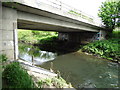
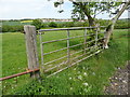
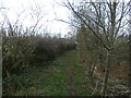
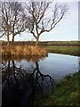
41 photos from this area
Area Information
Key information about the S73 9JF including its size, population, and administrative classification.
- Area Type
- Postcode
- Area Size
- 3.2 hectares
- Population
- 1725
- Population Density
- 477 people/km²
House Prices in S73 9JF
14
Properties
£86,938
Average Sold Price
£35,000
Lowest Price
£128,000
Highest Price
Showing 14 properties
| Address | Type | Beds | Baths | Last Sale Price | Last Sale Date | |
|---|---|---|---|---|---|---|
| 156 Doncaster Road, Darfield, Barnsley, S73 9JF | house | - | - | £110,000 | Jul 2025 | |
| 160 Doncaster Road, Darfield, Barnsley, S73 9JF | house | 3 | 1 | £128,000 | Aug 2022 | |
| 162 Doncaster Road, Darfield, Barnsley, S73 9JF | Semi-detached | 3 | 1 | £80,000 | Apr 2015 | |
| 152 Doncaster Road, Darfield, Barnsley, S73 9JF | Semi-detached | 3 | 1 | £67,000 | Mar 2015 | |
| 164 Doncaster Road, Darfield, Barnsley, S73 9JF | Terraced | 3 | 1 | £115,000 | Aug 2007 | |
| 150 Doncaster Road, Darfield, Barnsley, S73 9JF | Semi-detached | - | - | £98,000 | Mar 2006 | |
| 172 Doncaster Road, Darfield, Barnsley, S73 9JF | Semi-detached | - | - | £62,500 | Aug 2001 | |
| 158 Doncaster Road, Darfield, Barnsley, S73 9JF | house | - | - | £35,000 | Dec 1996 | |
| 154 Doncaster Road, Darfield, Barnsley, S73 9JF | Terraced | - | - | - | - | |
| 148 Doncaster Road, Darfield, Barnsley, S73 9JF | house | - | - | - | - |
Page 1 of 2
Energy Efficiency in S73 9JF
Amenities
Schools
| Rank | School | Type | Entry gender | Ages |
|---|
Explore more schools in this area
Go to Schools tabDemographics
Household Size
Two person
most common
Accommodation Type
Houses
most common
Tenure
60
majority
Ethnic Group
White
most common
Religion
N/A
most common
Household Composition
N/A
most common
Age
47
median
Adults (30-64 years)
most common
Household Deprivation
N/A
with no deprivation
NS-SEC
23
in Lower managerial occupations
Explore more demographic insights in this area
Go to Demographics tabPlanning
Planning Constraints
- Flood RiskPremium
- Ramsar Wetland SitesPremium
- Area of Outstanding Natural BeautyPremium
- Protected Nature ReservePremium
- Protected WoodlandPremium