Area Overview for S73 8SU
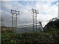
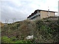
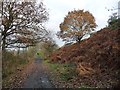
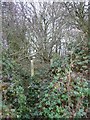
Photos of S73 8SU
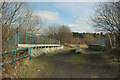
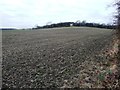
![The former Stairfoot lock flight, Dearne & Dove Canal [1] in S73 8SU](https://images.propbar.co.uk/images/geograph/52/15/5215462_120.jpg)
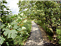
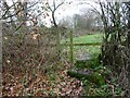
![Former towpath, Dearne & Dove Canal [1] in S73 8SU](https://images.propbar.co.uk/images/geograph/52/15/5215467_120.jpg)
41 photos from this area
Area Information
Key information about the S73 8SU including its size, population, and administrative classification.
- Area Type
- Postcode
- Area Size
- 36.5 hectares
- Population
- 2022
- Population Density
- 1719 people/km²
House Prices in S73 8SU
2
Properties
-
Average Sold Price
-
Lowest Price
-
Highest Price
Showing 2 properties
| Address | Type | Beds | Baths | Last Sale Price | Last Sale Date | |
|---|---|---|---|---|---|---|
| Hesley Group And Low Laithes Home Collection, Low Laithes Village, Old Farm Lane, Ardsley, Barnsley, S73 8SU | residential_space | - | - | - | - | |
| Lite Bytes Cafe, Low Laithes Village, Old Farm Lane, Ardsley, Barnsley, S73 8SU | residential_space | - | - | - | - |
Energy Efficiency in S73 8SU
Amenities
Schools
| Rank | School | Type | Entry gender | Ages |
|---|
Explore more schools in this area
Go to Schools tabDemographics
Household Size
Two person
most common
Accommodation Type
Houses
most common
Tenure
50
majority
Ethnic Group
White
most common
Religion
N/A
most common
Household Composition
N/A
most common
Age
47
median
Adults (30-64 years)
most common
Household Deprivation
N/A
with no deprivation
NS-SEC
21
in Lower managerial occupations
Explore more demographic insights in this area
Go to Demographics tabPlanning
Planning Constraints
- Flood RiskPremium
- Ramsar Wetland SitesPremium
- Area of Outstanding Natural BeautyPremium
- Protected Nature ReservePremium
- Protected WoodlandPremium