Area Overview for S73 0WH
Photos of S73 0WH
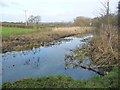
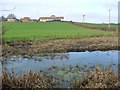
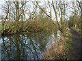
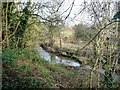
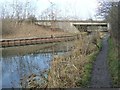
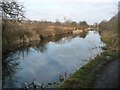
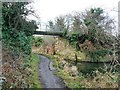
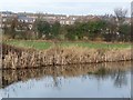
45 photos from this area
Area Information
Key information about the S73 0WH including its size, population, and administrative classification.
- Area Type
- Postcode
- Area Size
- 7.1 hectares
- Population
- 1406
- Population Density
- 2303 people/km²
House Prices in S73 0WH
52
Properties
£212,399
Average Sold Price
£135,000
Lowest Price
£310,000
Highest Price
Showing 52 properties
| Address | Type | Beds | Baths | Last Sale Price | Last Sale Date | |
|---|---|---|---|---|---|---|
| 60 Lundhill Drive, Wombwell, Barnsley, S73 0WH | Semi-detached | 3 | 2 | £220,000 | Nov 2025 | |
| 70 Lundhill Drive, Wombwell, Barnsley, S73 0WH | Detached | 3 | - | £215,000 | Sep 2025 | |
| 16 Lundhill Drive, Wombwell, Barnsley, S73 0WH | house | - | - | £175,000 | Mar 2025 | |
| 54 Lundhill Drive, Wombwell, Barnsley, S73 0WH | Semi-detached | 3 | 2 | £200,000 | Oct 2024 | |
| 46 Lundhill Drive, Wombwell, Barnsley, S73 0WH | house | - | - | £299,995 | Jul 2023 | |
| 42 Lundhill Drive, Wombwell, Barnsley, S73 0WH | house | - | - | £297,500 | Jun 2023 | |
| 32 Lundhill Drive, Wombwell, Barnsley, S73 0WH | Semi-detached | 3 | 2 | £204,995 | Jun 2023 | |
| 28 Lundhill Drive, Wombwell, Barnsley, S73 0WH | house | - | - | £264,995 | Jun 2023 | |
| 30 Lundhill Drive, Wombwell, Barnsley, S73 0WH | house | - | - | £205,000 | Jun 2023 | |
| 44 Lundhill Drive, Wombwell, Barnsley, S73 0WH | house | - | - | £224,995 | Jun 2023 |
Page 1 of 6
Energy Efficiency in S73 0WH
Amenities
Schools
| Rank | School | Type | Entry gender | Ages |
|---|
Explore more schools in this area
Go to Schools tabDemographics
Household Size
Two person
most common
Accommodation Type
Houses
most common
Tenure
84
majority
Ethnic Group
White
most common
Religion
N/A
most common
Household Composition
N/A
most common
Age
47
median
Adults (30-64 years)
most common
Household Deprivation
N/A
with no deprivation
NS-SEC
28
in Lower managerial occupations
Explore more demographic insights in this area
Go to Demographics tabPlanning
Planning Constraints
- Flood RiskPremium
- Ramsar Wetland SitesPremium
- Area of Outstanding Natural BeautyPremium
- Protected Nature ReservePremium
- Protected WoodlandPremium