Area Overview for S73 0PU
Photos of S73 0PU
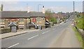

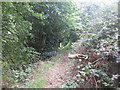
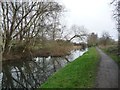
![The end of the line [for now] in S73 0PU](https://images.propbar.co.uk/images/geograph/47/63/4763198_120.jpg)
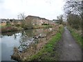
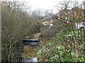
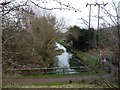
36 photos from this area
Area Information
Key information about the S73 0PU including its size, population, and administrative classification.
- Area Type
- Postcode
- Area Size
- 1.5 hectares
- Population
- 1752
- Population Density
- 1344 people/km²
House Prices in S73 0PU
42
Properties
£98,805
Average Sold Price
£30,000
Lowest Price
£189,000
Highest Price
Showing 42 properties
| Address | Type | Beds | Baths | Last Sale Price | Last Sale Date | |
|---|---|---|---|---|---|---|
| 39 Cemetery Road, Hemingfield, Barnsley, S73 0PU | Terraced | 2 | 1 | £86,000 | Oct 2024 | |
| 34 Cemetery Road, Hemingfield, Barnsley, S73 0PU | Terraced | 2 | - | £118,000 | May 2024 | |
| 16 Cemetery Road, Hemingfield, Barnsley, S73 0PU | Terraced | 2 | 1 | £116,920 | Nov 2023 | |
| 8 Cemetery Road, Hemingfield, Barnsley, S73 0PU | Terraced | - | - | £125,000 | Mar 2023 | |
| 1 Cemetery Road, Hemingfield, Barnsley, S73 0PU | house | - | - | £140,000 | Aug 2022 | |
| 41 Cemetery Road, Hemingfield, Barnsley, S73 0PU | Retail | 3 | - | £189,000 | Jul 2022 | |
| 33 Cemetery Road, Hemingfield, Barnsley, S73 0PU | house | - | - | £170,000 | May 2021 | |
| 37 Cemetery Road, Hemingfield, Barnsley, S73 0PU | house | - | - | £84,000 | May 2021 | |
| 26 Cemetery Road, Hemingfield, Barnsley, S73 0PU | house | - | - | £101,500 | May 2021 | |
| 9 Cemetery Road, Hemingfield, Barnsley, S73 0PU | Detached | 4 | 2 | £153,000 | Oct 2018 |
Page 1 of 5
Energy Efficiency in S73 0PU
Amenities
Schools
| Rank | School | Type | Entry gender | Ages |
|---|
Explore more schools in this area
Go to Schools tabDemographics
Household Size
Two person
most common
Accommodation Type
Houses
most common
Tenure
77
majority
Ethnic Group
White
most common
Religion
N/A
most common
Household Composition
N/A
most common
Age
47
median
Adults (30-64 years)
most common
Household Deprivation
N/A
with no deprivation
NS-SEC
32
in Lower managerial occupations
Explore more demographic insights in this area
Go to Demographics tabPlanning
Planning Constraints
- Flood RiskPremium
- Ramsar Wetland SitesPremium
- Area of Outstanding Natural BeautyPremium
- Protected Nature ReservePremium
- Protected WoodlandPremium